
Country Colombia Established October 5, 1991 Area rank 1st Area 109,665 km² | Region Amazonía Region Capital Leticia Time zone UTC-05 Population 74,541 (2013) | |
 | ||
Points of interest Parque Santander, Reserva Natural Tanimboca, Museo Etnográfico del Banc, Reserva Natural Omagua, Reserva Victoria Regia | ||
Department of Amazonas (Spanish: Departamento del Amazonas, [amaˈsonas]) is a department of Colombia in the south of the country. It is the largest department in area while also having the 3rd smallest population. Its capital is Leticia. Its name comes from the Amazon River which drains in the department, and the Amazon rainforest which covers it.
Contents
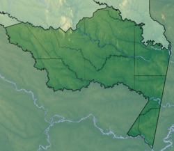
- Map of Amazonas Department Colombia
- Toponymy
- Culture
- National parks
- Municipalities and communities
- References
Map of Amazonas Department, Colombia
Toponymy
The department name comes from the name of the Amazon River. The river was named by the Spanish explorer Francisco de Orellana (1511 - 1546), who, on his voyage of exploration, said he was attacked by "fierce females" looked like Amazons of the Greek mythology, however, the existence of a female warrior tribe in that time hasn’t been demonstrated and it is possible that they were long-haired Native American warriors who impressed the conqueror who called the jungle and the river with the name of Amazon.
Culture
The following ethnic groups are found in the department: Bora, Cocama, Macuna, Mirana, Okaina, Ticunas, Tucano, Uitoto, Yagua and Yucuna, among others. These groups are more than 5,000 years old.
National parks
Department of Amazonas covers 109,665 km2 of area protected,most it under name of "forest reserve" since 1959, currently has 4 "National Parks" (Amacayacú, Cahuinarí, Yagoje Apaporis and Rio Puree).
Municipalities and communities
- El Encanto
- La Chorrera
- La Pedrera
- La Victoria
- Leticia
- Mirití-Paraná
- Puerto Alegría
- Puerto Arica
- Puerto Nariño
- Puerto Santander
- Tarapacá