
Local time Monday 6:39 PM | Region Normandy Arrondissement Caen Area 5.62 km² | |
 | ||
Intercommunality Villers-Bocage Intercom Weather 6°C, Wind SW at 27 km/h, 81% Humidity | ||
Amayé-sur-Seulles is a French commune in the Calvados department in the Normandy region of northwestern France.
Contents
- Map of 14310 AmayC3A9 sur Seulles France
- Geography
- Administration
- Demography
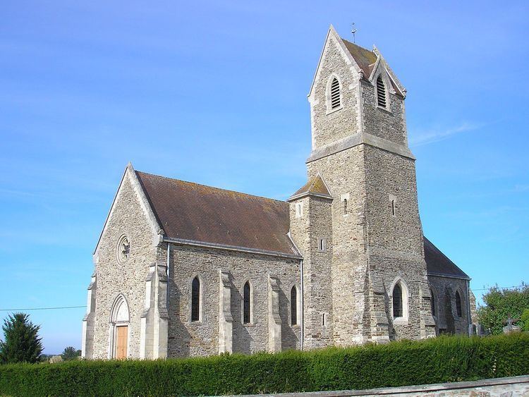
- Sites and Monuments
- References
Map of 14310 Amay%C3%A9-sur-Seulles, France
The inhabitants of the commune are known as Amayéens or Amayéennes
Geography
Amayé-sur-Seulles is located four kilometres west of Villers-Bocage and 20 kilometres south of Bayeux in the Seulles valley. It can be accessed by road D71 coming west from Villers-Bocage through the heart of the commune and village and continuing west to Caumont-l'Evente. The road D193 running west from Cahagnes to Villers-Bocage forms the southern boundary of the commune. The road D215 also starts from the hamlet of Saint-German in the commune and runs south-west to Tracy-Bocage. There are also many small country roads in the commune. In addition to the village there are also the hamlets of Saint-German to the east and La Vallee to the north of the village. The commune consists entirely of farmland.
La Seulles river passes through the northern part of the commune and Le Calichon which forms the northern boundary of the commune flows into it. Another stream which rises near the village flows north forming part of the eastern boundary of the commune and also joins La Seulles. In the south-east the Ruisseau du Caudray forms the south-eastern boundary of the commune and flows eastwards to join La Seulline river. The Ruisseau de Pont Chouquet flows into the Caudray and forms part of the eastern boundary of the commune.
Administration
List of Successive Mayors of Amayé-sur-Seulles
(Not all data is known)
Demography
In 2010, the commune had 200 inhabitants. The evolution of the number of inhabitants is known through the population censuses conducted in the town since 1793. From the 21st century, a census of municipalities with fewer than 10,000 inhabitants is held every five years, unlike larger towns that have a sample survey every year.
Sources : Ldh/EHESS/Cassini until 1962, INSEE database from 1968 (population without double counting and municipal population from 2006)