
Area 277.7 km² | Time zone EET (UTC+2) Local time Monday 5:58 PM | |
 | ||
Weather 12°C, Wind NE at 8 km/h, 94% Humidity | ||
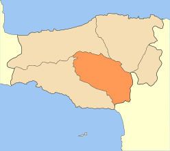
Amari (Greek: Αμάρι) is a village and a municipality in Rethymno regional unit, Crete, Greece. The seat of the municipality is the village Agia Foteini. The municipal unit has an area of 277.285 km2 (107.060 sq mi). One of the major geographic features of Amari is the Amari Valley, a landform of high elevation known for olive cultivation. It is thought that Monastiraki was developed by Phaistos inhabitants founding a satellite center as they pushed out into the Amari Valley.
Contents
Map of Amari, Greece
Municipality
The municipality Amari was formed at the 2011 local government reform by the merger of the following 2 former municipalities, that became municipal units:
Province
The province of Amari (Greek: Επαρχία Αμαρίου) was one of the provinces of the Rethymno Prefecture. It had the same territory as the present municipality. It was abolished in 2006.