
Length 32 km (19.9 mi) Area 240 km² | Width 10 km (6 mi) Administrative subdivision Tuamotus Island group Tuamotus | |
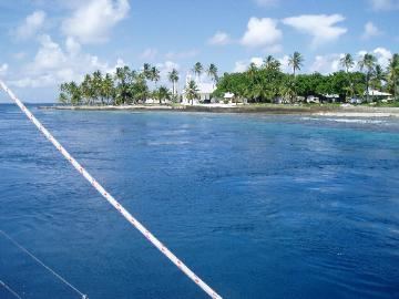 | ||
Amanu, Timanu, or Karere, is an atoll in the Tuamotu archipelago. Amanu lies at right angles to neighbouring Hao Atoll; this orientation is quite rare for the Tuamotu atolls.
Contents
Map of Amanu, French Polynesia
It is situated 900 km east of Tahiti and 15 km north of Hao. The atoll is 32 km long (northeast to southwest) and 10 km wide, but only 9.6 km² of its land is above water, the rest forming the central lagoon. The surface area of Amanu's wide lagoon is 240 km². There are two navigable passes to enter it.
Amanu has 195 inhabitants. The main village is Ikitake.
History
The first recorded European who arrived to Amanu Atoll was Portuguese navigator Pedro Fernández de Quirós who navigated for Spain, on 12 February 1606, while sailing across the Pacific Ocean in search of Terra Australis. However, several 16th-century Spanish cannons were found on Amanu in 1929, indicating that an earlier Spanish expedition had visited Tuamotu. Some historians notably Robert Adrian Langdon believe the cannons belonged to the caravel San Lesmes, which was split off from the Loaísa expedition which sailed the Pacific Ocean in 1526.
It was later visited by Spanish explorer Domingo de Boenechea in 1774, that charted them as Las Ánimas (The Souls in Spanish).
Russian explorer Fabian Gottlieb von Bellingshausen visited Amanu in 1820 on ships Vostok and Mirni. He named this atoll "Moller".
Administration
Administratively Amanu forms a commune in French Polynesia which includes the atolls of Rekareka (uninhabited) and Tauere. The Amanu commune is associated with the Hao commune.