Kalpana Kalpana (Editor)

Alubijid, Misamis Oriental

Updated on
Edit
Like
Comment
Share on FacebookTweet on TwitterShare on LinkedInShare on Reddit
Country
  
Philippines

Time zone
  
PST (UTC+8)

Area
  
85.56 km²

Province
  
Misamis Oriental

Barangays
  
16

ZIP code
  
9018

Local time
  
Monday 4:43 PM

Dialling code
  
88

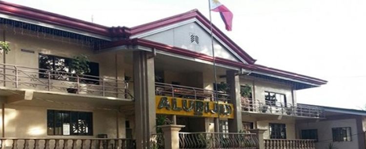
Alubijid, Misamis Oriental wwwalubijidmisorgovphwpcontentuploads20150

Region
  
Northern Mindanao (Region X)

District
  
2nd district of Misamis Oriental

Weather
  
28°C, Wind N at 11 km/h, 83% Humidity

Alubijid is a fourth class municipality in the province of Misamis Oriental, Philippines. According to the 2015 census, it has a population of 29,724 people.

Contents

Map of Alubijid, Misamis Oriental, Philippines

Etymology

The municipality name, "Alubijid", pronounced alubihid due to Spanish accent, is the local term for the hog plum tree.

Barangays

Alubijid is politically subdivided into 16 barangays.

Schools

College:

  • Bukidnon State University- Alubijid Extension
  • High School

  • Alubijid National Comprehensive High School
  • Lourdes National High School
  • Living Hope Christian Academy (Private)
  • Elementary

  • Alubijid Central School
  • Baybay Elementary School
  • Benigwayan Elementary School
  • Calatcat Elementary School
  • Lagtang Elementary School
  • Lanao Elementary School
  • Loguilo Elementary School
  • Lourdes Elementary School
  • Lumbo Elementary School
  • Molocboloc Elementary School
  • Sampatulog Elementary School
  • Sungay Elementary School
  • Talaba Elementary School
  • Taparak Elementary School
  • Tugasnon Elementary School
  • Tula Elementary School
  • References

    Alubijid, Misamis Oriental Wikipedia