
Population 407 (2011) Civil parish Alpraham Local time Sunday 11:33 PM | OS grid reference SJ584595 Unitary authority Dialling code 01829 Post town Tarporley | |
 | ||
Weather 7°C, Wind S at 18 km/h, 82% Humidity | ||
Alpraham is a village and civil parish in the unitary authority of Cheshire East and the ceremonial county of Cheshire, England. The village includes a public house and football field, which are situated on the A51 road, between Nantwich and Chester, and is about seven miles north-west of Nantwich. The total population is around 400 people.
Contents
Map of Alpraham, Tarporley, UK
Alpraham formerly hosted the annual point to point for the Cheshire Hunt, towards the end of March. The event has now moved to a new location near Crewe.
Annually in September, there is a Village Day held on the Alpraham football pitch, with stalls and events such as tractor rides, a penalty shoot-out competition and a tug-of-war.
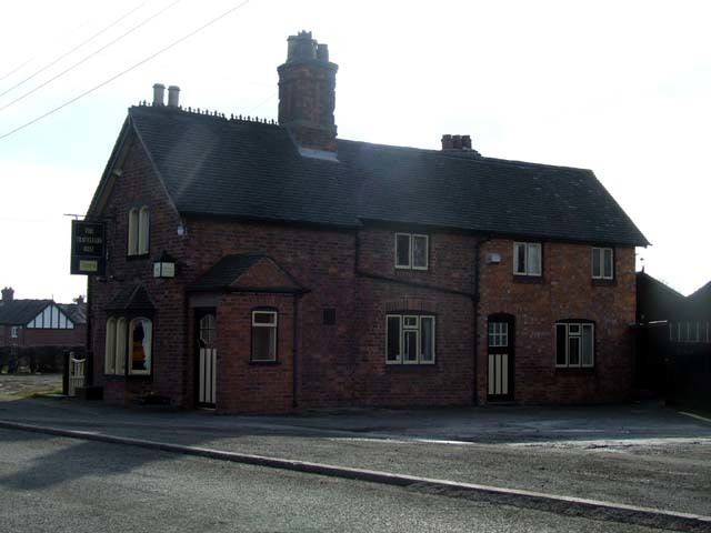
The Travellers Rest public house is on the Campaign for Real Ale's National Inventory of Historic Pub Interiors. It was built in about 1850 and extended in 1937, and the interwar interior remains largely unchanged.
Black 5 at alpraham sidings
Demography
The 2001 Census gave the parish's population as 373, rising to 407 in 162 households in the 2011 Census. The population density was 0.6 persons/hectare in 2011, well below the average of 3.2 persons/hectare for Cheshire East.