
OS grid SH681474 Elevation 698 m | Pronunciation Welsh: [ˈaɬt ˈvaur] Topo map OS Landranger 115 Prominence 243 m | |
 | ||
Listing Marilyn, Hewitt, Nuttall Similar Moel Druman, Ysgafell Wen, Moelwyn Mawr, Moel‑yr‑hydd, Moelwyn Bach | ||
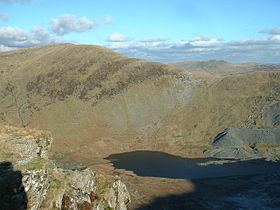
Allt-fawr is a mountain in Snowdonia, North Wales and forms part of the Moelwynion group.
Map of Allt Fawr, Blaenau Ffestiniog, UK
It is on the internal border of Snowdonia National Park, and overlooks the town of Blaenau Ffestiniog, with its numerous slate quarries, as well as the Tanygrisiau reservoir and power station. On the northern slope of Allt-fawr is the Oakeley Quarry, the world's largest underground slate mine. On the southern slope is the large Cwmorthin Quarry. These two mines are joined underneath the summit of Allt-fawr and the extensive chambering and adits are visible on the surface of the mountain where underground workings have collapsed.
References
Allt-fawr Wikipedia(Text) CC BY-SA