
County Monmouth Time zone Eastern (EST) (UTC-5) Elevation 10 m Zip code 08720 | State New Jersey FIPS code 3400790 Area 4.784 km² Area code Area codes 732 and 848 | |
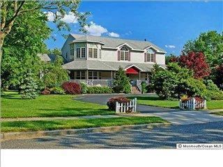 | ||
Allenwood is an unincorporated community and census-designated place (CDP) located within Wall Township, in Monmouth County, New Jersey, United States. As of the 2010 United States Census, the CDP's population was 925.
Contents
Map of Allenwood, Wall Township, NJ, USA
Geography
According to the United States Census Bureau, the CDP had a total area of 1.847 square miles (4.785 km2), including 1.732 square miles (4.486 km2) of land and 0.115 square miles (0.298 km2) of water (6.24%).
Census 2010
The 2010 United States Census counted 925 people, 309 households, and 258.9 families residing in the CDP. The population density was 534.0 per square mile (206.2/km2). The CDP contained 318 housing units at an average density of 183.6 per square mile (70.9/km2). The racial makeup of the CDP was 97.73% (904) White, 0.11% (1) Black or African American, 0.00% (0) Native American, 0.86% (8) Asian, 0.00% (0) Pacific Islander, 0.43% (4) from other races, and 0.86% (8) from two or more races. Hispanics or Latinos of any race were 2.81% (26) of the population.
Out of a total of 309 households, 36.9% had children under the age of 18 living with them, 75.1% were married couples living together, 5.8% had a female householder with no husband present, and 16.2% were non-families. 12.9% of all households were made up of individuals, and 6.8% had someone living alone who was 65 years of age or older. The average household size was 2.99 and the average family size was 3.30.
In the CDP, 26.2% of the population were under the age of 18, 7.7% from 18 to 24, 17.5% from 25 to 44, 36.6% from 45 to 64, and 12.0% who were 65 years of age or older. The median age was 44.3 years. For every 100 females the census counted 102.4 males, but for 100 females at least 18 years old, it was 96.8 males.
Census 2000
As of the 2010 United States Census there were 935 people, 309 households, and 261 families residing in the CDP. The population density was 199.5/km² (516.5/mi²). There were 318 housing units at an average density of 67.8/km² (175.7/mi²). The racial makeup of the CDP was 97.75% White, 0.11% Native American, 1.50% Asian, 0.11% from other races, and 0.53% from two or more races. Hispanic or Latino of any race were 1.71% of the population.
There were 309 households out of which 47.2% had children under the age of 18 living with them, 77.7% were married couples living together, 4.2% had a female householder with no husband present, and 15.5% were non-families. 13.6% of all households were made up of individuals and 4.5% had someone living alone who was 65 years of age or older. The average household size was 3.03 and the average family size was 3.36.
In the CDP the population was spread out with 30.8% under the age of 18, 5.0% from 18 to 24, 26.2% from 25 to 44, 28.2% from 45 to 64, and 9.7% who were 65 years of age or older. The median age was 40 years. For every 100 females there were 109.2 males. For every 100 females age 18 and over, there were 102.2 males.
The median income for a household in the CDP was $117,071, and the median income for a family was $120,472. Males had a median income of $61,985 versus $47,500 for females. The per capita income for the CDP was $40,148. None of the population or families were below the poverty line.