
Country United States Website www.allentownship.org Local time Sunday 4:56 AM Area code 610 | State Pennsylvania Time zone EST (UTC-5) Elevation 125 m Population 2,630 (2000) | |
 | ||
Weather 2°C, Wind W at 18 km/h, 51% Humidity Area 29.01 km² (28.75 km² Land / 26 ha Water) | ||
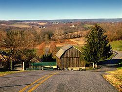
Allen Township is a township in Northampton County, Pennsylvania, United States. Allen Township is located in the Lehigh Valley region of the state.
Contents
- Map of Allen Township PA USA
- History
- Geography
- Neighboring municipalities
- Demographics
- Public education
- Notable residents
- References
Map of Allen Township, PA, USA
The population of Allen Township was 2,630 at the 2000 census.
History
The Kreidersville Covered Bridge was added to the National Register of Historic Places in 1980.
Geography
According to the United States Census Bureau, the township has a total area of 11.2 square miles (29 km2), of which, 11.1 square miles (29 km2) of it is land and 0.1 square miles (0.26 km2) of it (0.63%) is water. It is drained by the Lehigh River, via the Catasauqua Creek which separates it from Lehigh County. Its villages include Howertown, Kreidersville, Seemsville (also in East Allen Township,) and Weaversville (also in East Allen Township.)
Route 329 crosses Allen Township east-to-west on its path between the boroughs of Bath and Northampton. Other local roads of note include Bullshead Road, Cherryville Road, Howertown Road/Weaversville Road, Indian Trail Road, Kreidersville Road, Old Carriage Road, Seemsville Road, and Willowbrook Road.
Neighboring municipalities
Demographics
As of the census of 2000, there were 2,630 people, 1,001 households, and 805 families residing in the township. The population density was 237.1 people per square mile (91.6/km2). There were 1,030 housing units at an average density of 92.9/sq mi (35.9/km2). The racial makeup of the township was 98.67% White, 0.19% African American, 0.08% Native American, 0.08% Asian, 0.04% Pacific Islander, 0.42% from other races, and 0.53% from two or more races. Hispanic or Latino of any race were 1.10% of the population.
There were 1,001 households, out of which 31.2% had children under the age of 18 living with them, 70.7% were married couples living together, 5.6% had a female householder with no husband present, and 19.5% were non-families. 14.7% of all households were made up of individuals, and 5.7% had someone living alone who was 65 years of age or older. The average household size was 2.63 and the average family size was 2.91.
In the township the population was spread out, with 21.7% under the age of 18, 6.3% from 18 to 24, 27.5% from 25 to 44, 31.2% from 45 to 64, and 13.3% who were 65 years of age or older. The median age was 42 years. For every 100 females there were 97.4 males. For every 100 females age 18 and over, there were 98.3 males.
The median income for a household in the township was $54,464, and the median income for a family was $59,702. Males had a median income of $41,219 versus $27,930 for females. The per capita income for the township was $23,859. About 1.1% of families and 1.7% of the population were below the poverty line, including 1.6% of those under age 18 and 1.4% of those age 65 or over.
Public education
The Township is served by the Northampton Area School District.