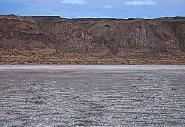
Lake type seasonal, alkali Surface elevation 1,320 m | ||
 | ||
Alkali Lake is a geographic sink in Lake County, Oregon, United States. It is in the Alkali Subbasin of the Summer Lake Basin watershed in southeastern Oregon, located 26 miles east of Christmas Valley, Oregon, northeast of Lake Abert, to the immediate west of Abert Rim and Highway 395.
Contents
Map of Alkali Lake, Oregon 97630, USA
Alkali Lake is thought to have reached a prehistoric maximum depth of 270.7 feet (82.5 meters) and covered about 1448.4 square miles (2,331 square kilometers). Since then, its water level has varied, with a drying trend. Notable features include dissolved alkaline salts averaging 10% of total brine weight in its seasonal waters and a nearby chemical disaster, Alkali Lake Chemical Waste Dump.
Plants
Plants known to occur in the dunes immediately north of the lake include:
Climate
According to the Köppen Climate Classification system, Alkali Lake has a steppe climate, abbreviated "BSk" on climate maps.
