
Website alins.ddl.net Area 183.2 km² Population 286 (2014) | Comarca Pallars Sobirà Elevation 1,048 m Local time Saturday 3:08 PM | |
 | ||
Weather 13°C, Wind W at 3 km/h, 34% Humidity | ||
Salida de tor a alins
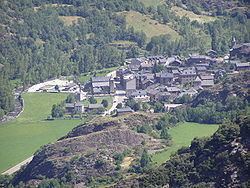
Alins is a municipality in the comarca of the Pallars Sobirà in Catalonia, Spain. It adjoins France and Andorra. It covers the valleys of the Noguera de Vallferrara and Tor rivers in the north of the comarca. The Pica d'Estats (3142 m, the highest point in Catalonia) is part of the Montcalm Massif on the frontier between this municipality and Ariège, France. A local road links the municipality with the L-504 road.
Contents
Map of 25574 Alins, Lleida, Spain
Demography
The municipality of Alins is formed of seven villages. Those marked with an asterisk are "delocalised municipal entities" (entitats municipals descentralitzades) and have their own local councils with limited powers.[1] Populations are given as of 2005:
Note
- ^ Entitats municipals descentralitzades are governed by the Llei Municipal i de Règim Local de Catalunya (8/1987 de 15 d'abril de 1987). They correspond to entidades locales menores in the rest of Spain (known as entitats locals menors in the Valencian Community and the Balearic Islands).
References
Alins Wikipedia(Text) CC BY-SA