
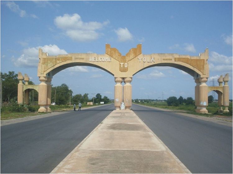
Country Nigeria Capital Yola Governor James Bala Ngilari | Area 36,917 km2 Founded 27 August 1991 | |
 | ||
Colleges and Universities Adamawa State University (Mubi), American University of Nigeria (Yola), Modibbo Adama University of Technology - Yola (Yola) Similar Taraba State, Gombe State, Borno State | ||
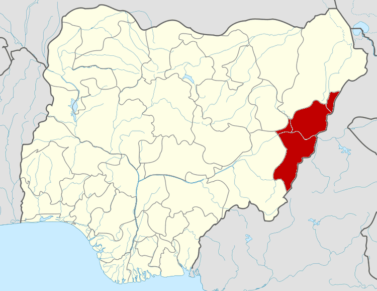
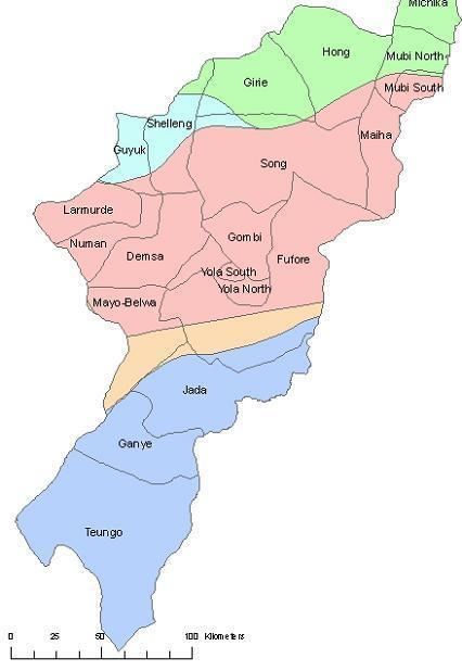
Map of Adamawa State
Adamawa is a state in northeastern Nigeria, with its capital at Yola. In 1991, when Taraba State was carved out from Gongola State, the geographical entity Gongola State was renamed Adamawa State, with four administrative divisions: Adamawa, Ganye, Mubi and Numan. It is the home of the American University of Nigeria in Yola and Modibbo Adama University of Technology Yola. It is one of the thirty-six states that constitute the Federal Republic of Nigeria.
Contents
- Map of Adamawa State
- Wedding activities in thukumichika adamawa state nigeria avi
- This is mubi town for adamawa state
- Geography
- Economy
- History
- Emirs of Adamawa
- Impact of Islamist insurgency
- Sites of interest
- Local Government Areas
- Key people from Adamawa State
- References
On May 14, 2013, President Goodluck Jonathan declared a state of emergency in Adamawa State, along with neighboring Borno State and Yobe State, due to the activities of Boko Haram.
Wedding activities in thukumichika adamawa state nigeria avi
This is mubi town for adamawa state
Geography
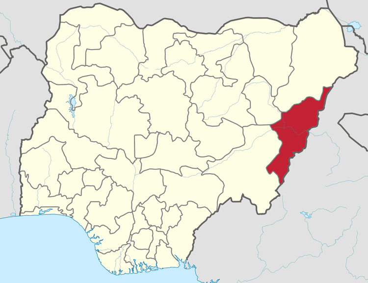
Adamawa is one of the largest states of Nigeria and occupies about 36,917 square kilometres. It is bordered by the states of Borno to the northwest, Gombe to the west and Taraba to the southwest. Its eastern border forms the national eastern border with Cameroon.
Topographically, it is a mountainous land crossed by the large river valleys – Benue, Gongola and Yedsarem. The valleys of the Cameroon, Mandara and Adamawa mountains form part of the landscape.
Economy
The major occupation of the people is farming as reflected in their two notable vegetational zones, tile Sub-Sudan and Northern Guinea Savannah Zone. Their cash crops are cotton and groundnuts while food crops include maize, yam, cassava, guinea corn, millet and rice.
The village communities living on the banks of the rivers engage in fishing while the Fulanis are cattle rearers. The state has a network of roads linking all parts of the country.
The development of many communities in the state can be traced to the colonial era when the Germans ruled a swath of territory known as the Northern and Southern Kameruns from Dikwa in the North to Victoria (Limbe) on the Atlantic coast in the 19th century. These were however handed over, as UN Trustee Territories, to the British at the end of the first World War with the signing of the Versailles Treaty. After a series of plebiscites, the Northern Kameruns joined Nigeria to form the then Sardauna Province, and the Southern Kameruns formed a Confederation with French speaking Cameroon.
Adamawa State is home to the headquarters of two indigenous churches, the Church of the Brethren in Nigeria (EYN Church) with its headquarters in Mubi in the northern zone of the state, and the Lutheran Church of Nigerian (LCCN Church) with headquarters in Numan in the southern zone of the state. The Church of the Brethren in Nigeria (EYN church) was founded in Garkida Gombi Local Government of the state in March 1923 by American missionaries. The Lutheran Church of Christ in Nigeria (LCCN Church) was founded in Numan by Dutch missionaries in 1913.
History
Before it became a state in Nigeria, Adamawa was a subordinate kingdom of the Sultanate of Sokoto which also included much of northern Cameroon. The rulers bear the title of emir ("lamido" in the local language, Fulfulde).
The name "Adamawa" came from the founder of the kingdom, Modibbo Adama, a regional leader of the Fulani Jihad organized by Usumaanu dan Fodio of Sokoto in 1804. Modibbo Adama came from the region of Gurin (now just a small village) and in 1806 received a green flag for leading the jihad in his native country. In the following years Adama conquered many lands and tribes. In 1838 he moved his capital to Ribadu, and in 1839 to Joboliwo. In 1841 he founded Yola, where he died in 1848. After the European colonization (first by Germany and then by Britain) the rulers remained as emirs, and the line of succession has continued to the present day.
Emirs of Adamawa
Emirs of Adamawa have included:
Impact of Islamist insurgency
Adamawa State has been impacted by the Islamist insurgency in Nigeria. As of November 30, 2014, the state has become home to camps housing an estimated 35,000 internally displaced persons fleeing violence from Boko Haram in locations such as Mubi, Madagali, Askira Uba, Bama, and Gwoza, in the states of Adamawa, Borno, and Yobe. Another 100,000 internally displaced persons are estimated to be living in households outside the camps, and with friends or relatives. Some Nigerians who had earlier fled to Cameroon have now been repatriated. Yet another estimate placed the number of internally displaced persons around Yola at 400,000. Organizations serving the community include the Adamawa Peace Initiative (API), a group of business, religious, and community leaders, and the Adamawa Muslim Council. The United States Agency for International Development has pledged to provide continuing humanitarian assistance.
A measles outbreak was reported in the camps in January 2015.
Sites of interest
Local Government Areas
Adamawa State consists of twenty-one Local Government Areas (LGAs):