
Country Mexico Highest elevation 2,000 m (7,000 ft) Postal code 30001 Area 90.48 km² | State Veracruz Time zone CST (UTC-6) Climate Cfb Local time Tuesday 7:17 PM | |
 | ||
Weather 16°C, Wind SE at 8 km/h, 74% Humidity | ||
Acajete Municipality is a municipality located in the central zone in the state of Veracruz, about 20 km from state capital Xalapa. It has a surface of 90.48 km2. It is located at 19°58′N 97°00′W. In the middle of 1586 this village was formed, on one of the adjoining old men of Tlacolulan's dominion. The decree N ° 64 of November 3, 1893 extinguished the municipality of La Hoya, annexing its territory to San Salvador Acajete. On November 5, 1932, the municipal head-board San Salvador Acajete changes the name to Acajete.
Contents
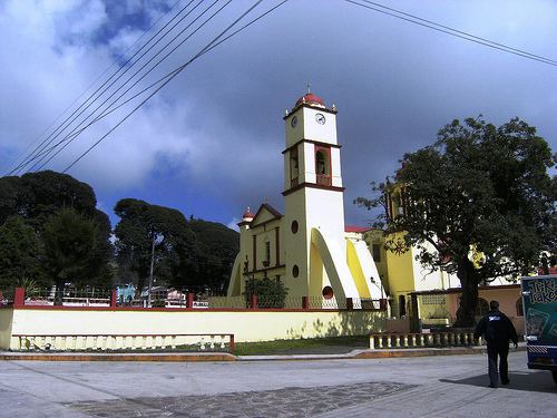
Map of Acajete, Ver., Mexico
Geographic limits
Acajete Municipality is delimited to the north by Tlacolulan and Las Vigas de Ramírez to the east by Rafael Lucio, to the south by Tlalnelhuayocan and to the west by Perote. It is watered by affluent creeks of the Río Sedeño, which are tributaries of the Actopan. The principal creek is the Pixquiac.
Agriculture
It produces principally maize, potatoes, apples, pear and plum.
Celebrations
In Acajete , in August takes place the celebration in honor to San Salvador, Patron of the town, and in December takes place the celebration in honor to Virgen de Guadalupe.
Weather
The weather in Acajete is very cold and wet all year with rains in summer and autumn.