
 | ||
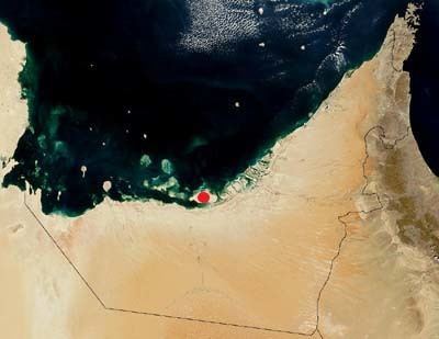
Abu al Abyad (formerly Abu al Jirab) is the largest of about 200 islands along the coast of the United Arab Emirates. It is situated in the emirate of Abu Dhabi. Its area is 306 square kilometres (118 sq mi). Settlements on the island include Al Jirab, Bū Līfīyāt, and Jazirah.
Map of Abu Al Abyad - Abu Dhabi - United Arab Emirates
The eastern section of the island is called Al Jirab (24°11′25″N 53°53′46″E), while the western section is called Muqay shiţ (24°11′20″N 53°45′08″E), and the westernmost point of the island is known as Ra’s Muqay (24°10′04″N 53°37′24″E).
References
Abu al Abyad Wikipedia(Text) CC BY-SA