
Incorporated 1892 Area code(s) 410 Zip code 21001 Population 15,120 (2013) | County Harford Time zone Eastern (UTC-5) Elevation 29 m Local time Tuesday 7:23 AM | |
 | ||
Country United States of America Weather 4°C, Wind NE at 0 km/h, 90% Humidity | ||
Driving to aberdeen maryland
Aberdeen is a city in Harford County, Maryland, 26 miles (42 km) from Baltimore. The population was 14,959 at the 2010 United States Census. Aberdeen is the largest municipality in Harford County.
Contents
- Driving to aberdeen maryland
- Map of Aberdeen MD USA
- New homes at eagle s rest in aberdeen maryland
- History
- The Village of Aberdeen
- The Town of Aberdeen
- The Town Board of Commissioners
- Presidents Aberdeen Board of Commissioners
- The City of Aberdeen
- Geography
- Climate
- 2000 census
- 2010 census
- Government
- Mayors of Aberdeen
- Aberdeen City Council
- Aberdeen City Manager
- Harford County Council
- Maryland General Assembly
- Congressional Delegation
- Aberdeen Proving Ground
- Notable people
- Aberdeen IronBirds
- Media
- References
Map of Aberdeen, MD, USA
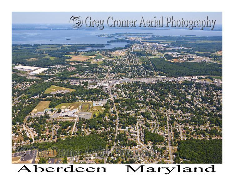
Aberdeen is part of the Baltimore-Towson Metropolitan Statistical Area (MSA), which is the 20th-largest United States metropolitan area. The nearest city to Aberdeen is Havre de Grace, Maryland, 4.8 miles (7.7 km) to the northeast.
New homes at eagle s rest in aberdeen maryland
History
Aberdeen was named after Aberdeen, Scotland, by immigrating Scots.
The James B. Baker House, Chestnut Ridge, Griffith House, Poplar Hill, Sophia's Dairy, and Swansbury are listed on the National Register of Historic Places.
The Village of Aberdeen
The Village of Aberdeen was a development by Edmund Law Rogers around 1800. The name originated from its mother city, Aberdeen, Scotland, as a result of the close relationship the Rogers family of Baltimore had with their cousin, the Earl of Aberdeen, who became Prime Minister of Great Britain in 1852. The area now known as Aberdeen is a cluster of three communities
The Town of Aberdeen
In 1892, Aberdeen was incorporated as a Town, under Chapter 136 of the Acts of 1892.
The Town Board of Commissioners
When incorporated as a Town, Aberdeen government was led by a board of commissioners.
In 1992, the Town of Aberdeen revised the Charter and became the City of Aberdeen with an Elected Mayor. The first Mayor of the City of Aberdeen was Ruth Elliot. The second Mayor was Doug Wilson was elected Mayor in Fred Simmons was elected Mayor in 2005. Michael Bennett elected in 2007-2015 In 2015, Patrick McGrady was elected as the Mayor of Aberdeen and is currently serving a 4-year term.
Presidents – Aberdeen Board of Commissioners
The City of Aberdeen
In 1992, the 100th anniversary year of Aberdeen becoming a Town, Aberdeen incorporated as the City it is today.
Geography
According to the United States Census Bureau, the city has a total area of 6.81 square miles (17.64 km2), of which, 6.80 square miles (17.61 km2) is land and 0.01 square miles (0.03 km2) is water.
Climate
The climate in this area is characterized by hot, humid summers and generally mild to cool winters. According to the Köppen Climate Classification system, Aberdeen has a humid subtropical climate, abbreviated "Cfa" on climate maps.
2000 census
As of the census of 2000, there were 13,842 people, 5,475 households, and 3,712 families residing in the city. The population density was 2,166.2 people per square mile (836.4/km²). There were 5,894 housing units at an average density of 922.4 per square mile (356.1/km²). The racial makeup of the city was 64.90% White, 27.38% African American, 0.25% Native American, 2.48% Asian, 0.09% Pacific Islander, 1.42% from other races, and 3.47% from two or more races. Hispanic or Latino of any race were 3.45% of the population.
There were 5,475 households out of which 32.4% had children under the age of 18 living with them, 44.8% were married couples living together, 17.2% had a female householder with no husband present, and 32.2% were non-families. 26.8% of all households were made up of individuals and 10.7% had someone living alone who was 65 years of age or older. The average household size was 2.51 and the average family size was 3.02.
In the city, the population was spread out with 26.4% under the age of 18, 8.7% from 18 to 24, 28.6% from 25 to 44, 23.7% from 45 to 64, and 12.7% who were 65 years of age or older. The median age was 37 years. For every 100 females there were 90.6 males. For every 100 females age 18 and over, there were 85.8 males.
The median income for a household in the city was $39,190, and the median income for a family was $48,357. Males had a median income of $32,783 versus $26,025 for females. The per capita income for the city was $18,940. About 9.0% of families and 11.9% of the population were below the poverty line, including 15.9% of those under age 18 and 11.1% of those age 65 or over.
2010 census
As of the census of 2010, there were 14,959 people, 5,801 households, and 3,897 families residing in the city. The population density was 2,199.9 inhabitants per square mile (849.4/km2). There were 6,191 housing units at an average density of 910.4 per square mile (351.5/km2). The racial makeup of the city was 58.9% White, 30.5% African American, 0.4% Native American, 2.9% Asian, 0.3% Pacific Islander, 1.6% from other races, and 5.3% from two or more races. Hispanic or Latino of any race were 5.4% of the population.
There were 5,801 households of which 34.3% had children under the age of 18 living with them, 43.5% were married couples living together, 18.3% had a female householder with no husband present, 5.4% had a male householder with no wife present, and 32.8% were non-families. 26.7% of all households were made up of individuals and 10.8% had someone living alone who was 65 years of age or older. The average household size was 2.57 and the average family size was 3.09.
The median age in the city was 38 years. 24.7% of residents were under the age of 18; 9.2% were between the ages of 18 and 24; 24.9% were from 25 to 44; 28.6% were from 45 to 64; and 12.6% were 65 years of age or older. The gender makeup of the city was 47.8% male and 52.2% female.
Government
Since its incorporation as a city, Aberdeen has had a council-manager form of government. The Mayor and Council are elected to four-year terms in November, with terms beginning in November. The Mayor and Council define policy and appoint the City Manager who may be dismissed at any time, by vote of the Council. The City Manager, with the approval of the Council, appoints all officers and department heads who may be dismissed for cause by action of the City Manager.
Mayors of Aberdeen
Aberdeen City Council
The current Council members were elected by Voters to 4-year terms beginning in November 2011. Their terms expire in 2015.
Aberdeen City Manager
Randy Robertson July 1, 2016- Current Douglas R. Miller, City Manager 2007-2015
Harford County Council
Council District E
Maryland General Assembly
State Senate, District 34A
House of Delegates, District 34A
Congressional Delegation
US Senate
US House of Representatives, 2nd Congressional District
Aberdeen Proving Ground
Aberdeen is home to the U.S. Army's Aberdeen Proving Ground (APG). The proving ground was established by Act of Congress and came into operation in January 1918. APG is headquarters of the United States Army Test and Evaluation Command (ATEC). The proving ground occupies more than 72,500 acres (293 km2) in Harford County. More than 7,500 civilians and 5,000 military personnel work at APG.
Notable people
Aberdeen IronBirds
Cal Ripken Jr. and brother Billy are owners of the Aberdeen IronBirds minor league baseball team, which plays at Ripken Stadium.
Media
Aberdeen's local radio station is WAMD, broadcasting at 970 on the AM dial. Local newspaper coverage is provided by Harford County publications The Aegis and The Record. Electronic media covering Aberdeen issues is Aberdeen Patch and The Dagger Press (electronic)
Aberdeen is served by Baltimore television stations.
Aberdeen was host to the 2014 Bimmerfest East celebration on August 2, 2014.