
Topo map NAD 83/11U | Elevation 2,925 m | |
 | ||
Similar Abbot Pass hut, South Jasper Ranges, Hole‑in‑the‑Wall Provincial Park, First Oil Well in Western, Queen Elizabeth Ranges | ||
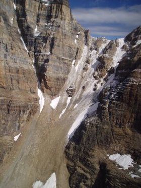
Abbot Pass lies between Mount Lefroy and Mount Victoria, in the divide between the valleys of Lake O'Hara and Lake Louise. It was named for Philip Stanley Abbot who died in 1896 in an attempt to climb Mount Lefroy with Charles Fay, Charles Thompson, and George T. Little.
Map of Abbot Pass, Improvement District No. 9, AB, Canada
Abbot Pass has a stone hut, built in 1922 by Swiss guides working for the Canadian Pacific Railway, now maintained by the Alpine Club of Canada.
References
Abbot Pass Wikipedia(Text) CC BY-SA