
- elevation 978 m (3,209 ft) Length 115 km Basin area 1,380 km² | - elevation 0 m (0 ft) Discharge 13.96 m³/s | |
 | ||
- location Tsubetsu, Hokkaidō, Japan - location Abashiri, Hokkaidō, Japan - average 13.96 m/s (493 cu ft/s) | ||
Abashiri River (網走川, Abashiri-gawa) is a river in Hokkaidō, Japan.
Contents
Map of Abashiri River, Abashiri, Hokkaido Prefecture, Japan
History
Around 1000 years ago, the Okhotsk culture settled the river basin and moved inland. Remains from the Jōmon period have been found on the bottom of Lake Abashiri.
Course
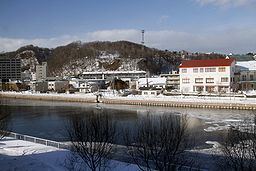
The Abashiri River rises in Tsubetsu on the slopes of Mount Ahoro of the Akan Volcanic Complex. The river leaves the mountains and is joined by Tsubetsu River and Bihoro River before flowing into Lake Abashiri. The river exits the lake and flows into the Sea of Okhotsk at Abashiri.
References
Abashiri River Wikipedia(Text) CC BY-SA