
Primarydestinations: PenrithWindermere | Length 54.7 km | |
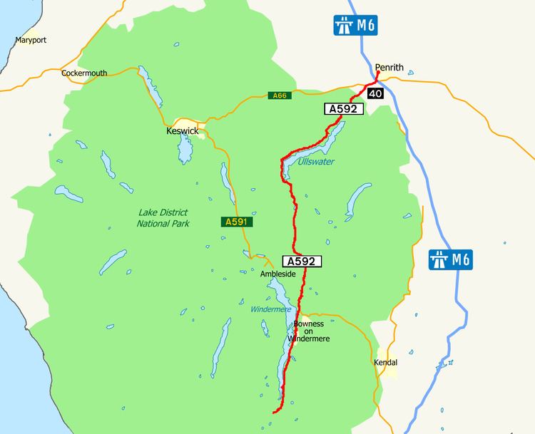 | ||
The A592 road is a major route running north-south through the English Lake District.
Map of A592, United Kingdom
The road connects Penrith (54.6639°N 2.7524°W / 54.6639; -2.7524 (A592 road (northern end))), and junction 40 of the M6 motorway), with Staveley at the southern tip of the lake, Windermere, (54.2672°N 2.9669°W / 54.2672; -2.9669 (A592 road (northern end))), which is skirted by the A592 on its eastern bank; the road also follows the northern/western bank of Ullswater. It passes through Glenridding, Patterdale, the town of Windermere (where it crosses the A591 road), Bowness-on-Windermere and Storrs.
The total length is just under 34 miles (55 km), including a short concurrency with the A66 road to the west of the motorway junction.
The A592 crosses Kirkstone Pass with a summit at 454 metres (1,490 ft) and is frequently closed in winter.