Suvarna Garge (Editor)

A57 autoroute

Updated on
Edit
Like
Comment
Share on FacebookTweet on TwitterShare on LinkedInShare on Reddit
Length
  
55 km

Highway system
  
Autoroutes of France

A57 autoroute

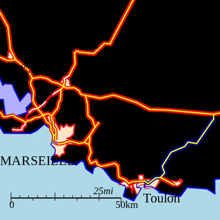
The A57 autoroute is a motorway in south eastern France.

Contents

Map of A57, France

It is 55 km long and runs from the Tunnel de Toulon to the A8 near Le Luc. The road is a toll motorway north of Toulon. It is operated by ESCOTA. It connects with the A570 to the town of Hyères.

Junctions

  • Exchange A8-A57 Junction with A8 to Aix and Nice.
  • 13 (Le Luc) Towns served: Le Luc, DN7
  • Service Area: Repenti
  • 12 (Le Luca) Towns served: Le Luc, Gonfaron (under construction)
  • 11 (Carnoules) Towns served: Carnoules, Pignans
  • Rest Area: Suvé du Vent
  • Péage de Cuers
  • 10 (Cuers-Nord) Towns served: Cuers, Pierrefeu-du-Var, Brignoles
  • 09 (Cuers-Sud) Towns served: Cuers
  • 08 (Sainte-Christine) Towns served: Sainte-Christine
  • 07 (Solliès-Toucas) Towns served: Solliès-Toucas, Les Terrins
  • 06 (La Farlède) Towns served: La Farlède, La Crau
  • Service Area: La Chamberte
  • Exchange A57-A570 Junction with A570 spur onto Hyères and Le Lavandou.
  • 05 (La Pauline) Towns served: La Pauline
  • 04 (La Garde) Towns served: La Valette-du-Var, La Garde
  • 03 (Toulon La Valette) Towns served: Toulon
  • 02 (Toulon Est) Towns served: Toulon, Giens via D559
  • 01a (Toulon-Centre) Towns served: Toulon
  • Exchange A55-A50 Junction with D559 to the A50 towards Aubagne and Marseille.
  • History

  • 1968 : Opening of the first section Toulon to La-Valette-du-Var then numbered the A54.
  • 2014 (March, 18th) : The tunnel de Toulon (Toulon's tunnel) opens its second section, in the Toulon -> Marseille direction (the first section, Marseille -> Toulon, is closed for several months for maintenance and improvements).
  • References

    A57 autoroute Wikipedia