Trisha Shetty (Editor)

A23 autoroute

Updated on
Edit
Like
Comment
Share on FacebookTweet on TwitterShare on LinkedInShare on Reddit
Length
  
43 km

Highway system
  
Autoroutes of France

A23 autoroute

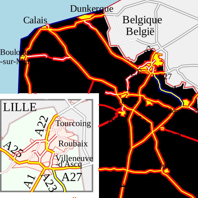
The A23 autoroute is a highway in northern France. It is 42.5 kilometres (26.4 mi) long.

Contents

Map of A23, France

Route

The road passes northwest/southeast from the Lille conurbation to the town of Valenciennes effectively linking the A1 and A2 autoroutes.

Junctions

  • 01 Echangeur A23/A27 Starts at junction with A27. Towns Served: Lille (west), Brussels (east)
  • 02 km 2 Lesquin Towns served: Lesquin
  • km 10 Rest Area: Genech
  • 00 km 26 Orchies Towns served:: Orchies, Douai, Tournai (Belgium)
  • 03 km 26 Marciennes Towns served: St-Amand-les-Eaux
  • km 29 Service Area: Millonfosse
  • 04 km 32 Hasnon Towns served: St-Amand-les-Eaux, Wallers
  • 05 km 35 St Amand les Eaux Towns served: St-Amand-les-Eaux, Tournai (Belgium)
  • 06 km 36 Raismes Towns served: St-Amand-les-Eaux, Tournai (Belgium)
  • 07 km 39 Petit-ForĂȘt Towns served: Raismes, Anzin
  • km 41 Rest Area: Petit-ForĂȘt
  • 08 km 43 Valenciennes-Nord Towns Served: Valenciennes
  • 09 km 43 Paris-Denain/Valenciennes-Ouest Towns Served: Valenciennes
  • km 43 Echangeur A23/A2: A2 to A23 Towns served: Paris (south), Brussels (north) and N30 (to Cambrai).
  • References

    A23 autoroute Wikipedia