
 | ||
The A183 road runs from South Shields in Tyne and Wear, through Sunderland and ends at Chester-le-Street in County Durham. It is a major route in South Tyneside, Sunderland and Chester-le-Street serving many areas and landmarks along its route.
Contents
Map of A183, United Kingdom
South Tyneside section
The road begins in the centre of South Shields, near the Town Hall, as Anderson Street. It becomes Ocean Road, famous locally for its Indian restaurants, and subject to traffic calming measures in recent years. The A183 then becomes Sea Road as it passes between the North and South Marine Parks as well as the Wouldhave Memorial and Sea Hotel. The road then continues along the seafront area of the town passing the fairground, Bents Park and Amphitheatre. The road then turns at Gandhi's Temple and becomes Mowbray Road as it passes Gypsies Green Stadium.
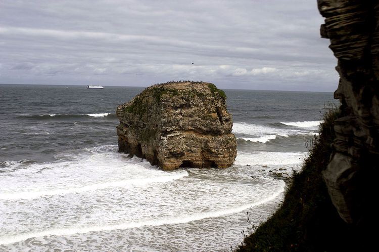
At the New Crown Hotel it becomes the Coast Road once past the junction for the Waters Edge public house, the road continues to Marsden without any turn junctions, passing The Leas on the Coastal side, the finishing point for the Great North Run. The A183 then meets the A1300 at its junction on Redwell Lane and continues as the Coast Road. Nest the road passes the famous Marsden Rock and Marsden Grotto on Marsden Beach. The A183 then continues at the Coast Road until it reaches Souter Lighthouse.
The road now becomes Mill Lane as it passes through Whitburn Colliery, the road becomein East Street as it passes through Whitburn Village itself. After passing Cornthwaite Park the A183 becomes Whitburn Bents Road and enters Sunderland.
Sunderland section
Once through Whitburn, the road enters Sunderland. It runs along the seafront, as Whitburn Road, passing the beaches of Seaburn (home of the annual Sunderland International Airshow which attracts 1.2 million visitors) and Roker.
It then winds alongside the River Wear, as Dame Dorothy Street, where it passes the National Glass Centre, the St. Peter's campus of the University of Sunderland, the seventh century St. Peter's Church, before crossing the river into the city centre at the Wearmouth Bridge - which it shares with the A1018 road. It loops around the north-western edge of the city centre as St. Mary's Way, Livingstone Road and St. Michael's Way, where it passes Sunderland Minster, before becoming Chester Road.
As Chester Road it runs past the city campus of the University, and through a commercial section before reaching the Sunderland Royal Hospital. It runs alongside Bishopwearmouth Cemetery toward the Grindon estate. It is here that it becomes a dual carriageway - running past the Pennywell and Hastings Hill estates, past the Sunderland Echo office to the A19 fly-over.
Past the A19 the road runs past the Herrington Country Park and the Penshaw Monument, through Penshaw, before reaching a large roundabout at Shiney Row with the A182. Originally. the road carried on through Shiney Row - but due to traffic-calming measures and the opening of a new link road past the new Biddick Woods Estate (which lies to the west of Shiney Row, the A183 shares the A182 for approx 1⁄2 mile (0.80 km), before coming onto its own again at Biddick Woods - then linking onto its original route just short of the county boundary near the site of the old cokeworks between Bournmoor and Shiney Row at Wapping Bridge). The link road will eventually continue through to Chilton Moor and connect onto the A690.
County Durham section
The road becomes single carriageway once more, and passes out of Sunderland through Bournmoor. It runs downhill alongside the river Wear, close to Lumley Castle. This stretch is called New Bridge Bank, and the road crosses over the New Bridge, one of the earliest crossings over the river Wear. The road ends at the A1(M) junction - the Blind Lane leads to Beamish on the A693 and the Shields Road leads into Chester-le-Street.