
Country Vietnam Capital A Luoi Area 1,229 km² Population 38,616 (2003) | Region North Central Coastal Time zone UTC + 7 (UTC+7) Province Thừa Thiên-Huế Province Local time Sunday 8:22 AM | |
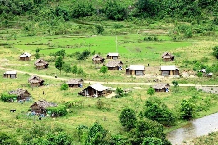 | ||
A Lưới is a rural district of Thừa Thiên-Huế Province in the North Central Coast region of Vietnam. It is located west in the highly mountainous area of A Shau Valley bordering Laos. The population includes many Bru, Hoa and Tà Ôi people. As of 2003 the district had a population of 38,616. The district covers an area of 1,229 km² and its capital lies at A Lưới, a former French airfield, later usd by the Americans in Operation Delaware and then by the North Vietnamese for courier flights.
Contents
Map of A L%C6%B0%E1%BB%9Bi District, Thua Thien Hue, Vietnam
Many areas and mountains in the A Luoi region became historical in the mid-late 1960s during the Vietnam War, such the Battle of A Shau, the 5th Special Forces Camp that was overrun in 1966, as well as the 4,878-foot Dong Re Lao Mountain best known as the "Signal Hill" that was seized by 1st Cavalry Division LRRP / Rangers in 1968 during Operation Delaware. Also, A Bia Mountain, known as the Hamburger Hill that was seized by members of the 101st Airborne Division.
A Lưới is connected to the former French colonial capital and coastal city Huế, one of the main historical cities in central Vietnam by National Road 49, a road notorious for poor safety because of the mountainous terrain and poor road surface. The A Lưới District has one town and 21 communes. The central town has gas stations, and a few guest-houses for travelers.
Get to A Luoi
There are many ways to get to A Luoi such as local bus at South Bus Station but it's a really local bus and not good one. Beside you can also rent private car to explore A Luoi 1 or 2 days. You can connect to Hue city or Hoian Town as well. It could be the best chance to take photo of the minority people on Vietnam Photo tour.