
Comarca Salnés Time zone CET (UTC+1) Elevation 9 m Population 5,006 (2014) | Demonym(s) Arousán, á Postal code 36626 Area 7 km² Province Pontevedra | |
 | ||
Points of interest Faro de Punta Cabalo, Parque Natural de Carreirón, Area Da Secada, Con do Forno (Mirador), Carreiron | ||
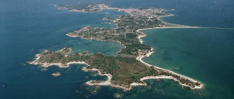
A Illa de Arousa is the only island municipality in Galicia, Spain in the province of Pontevedra. It is located in the heart of the Ria de Arousa. According to 2011 INE the island's population was 5,020 inhabitants. The population is divided into several neighborhoods, and places of interest are the lighthouse's environment, the island of Areoso (close to the Illa de Arousa) and Carreirón Natural Park, which is listed as a special protection zone for heron birds populations among other birds that inhabit the island. The Holy viewpoint is the highest point on the island. "San Xulián da Illa de Arousa" is the only parish in this island. Some of its beaches are the following ones: A Area da Secada, A Lavanqueira, O Vao, Camaxe, Carreirón, Espiñeiro and O Cabodeiro.
Contents
Map of A Illa de Arousa, Pontevedra, Spain
A Illa de Arousa has five ports. Xufre is the most important and the other important docks include O Campo, Chazo and Cabodeiro.
Etymology
According to E. Bascuas, "Arousa", registered as insulam Arauza in 899, would belong to the old European hydronymy, and is derived from the Indoeuropean root *er- 'flow, move'.