
First system formed December 15, 1988 Name Harry Tropical cyclones 14 | Last system dissipated May 30, 1989 Total depressions 14 Severe tropical cyclones 6 | |
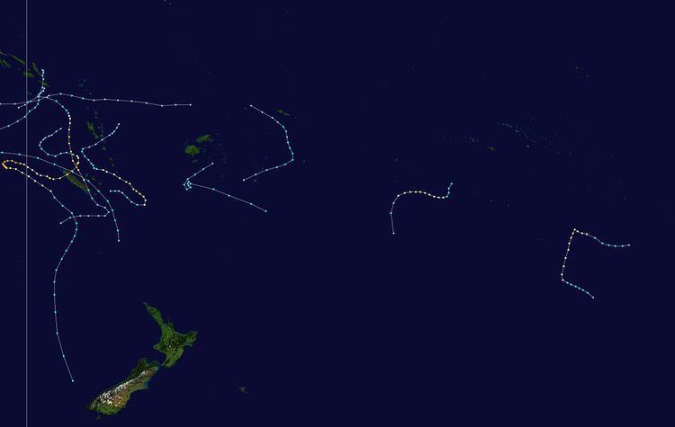 | ||
The 1988–89 South Pacific cyclone season was an active tropical cyclone season with an above average number of tropical cyclones observed.
Contents
- Tropical Cyclone Eseta
- Tropical Cyclone Delilah
- Tropical Cyclone Fili
- Tropical Cyclone Gina
- Severe Tropical Cyclone Harry
- Severe Tropical Cyclone Hinano
- Severe Tropical Cyclone Ivy
- Severe Tropical Cyclone Judy
- Tropical Cyclone Kerry
- Severe Tropical Cyclone Lili
- Tropical Cyclone Meena
- Tropical Depression 28P Ernie
- Other systems
- Season effects
- References
During the season despite positive values of the Southern Oscillation Index being recorded throughout the season, there was an unusual distribution of tropical cyclones with five developing between 180° and 140°W. This unusual distribution of tropical cyclones was attributed to the relatively rapid development of an active South Pacific Convergence Zone over an area of cooler than normal sea surface temperatures during January and February 1989.
Tropical Cyclone Eseta
On December 15, the FMS reported that a tropical depression had developed, within the monsoon trough just to the north of Vanuatu. The system subsequently persisted for a week with little change in intensity, as it gradually moved south-southwest over Vanuatu and New Caledonia. Between December 20–21, an area of high pressure developed to the south of the system, which prevented any further southwards movement. The system subsequently moved north-eastwards and passed over southern Vanuatu, before the FMS reported late on December 23, that the cyclone had become equivalent to a category 1 tropical cyclone and named it Eseta. At around this time the system was located about 525 km (325 mi) to the southwest of Nadi, Fiji and had started to move south-westwards as it interacted with a trough of low pressure in the Tasman Sea. During December 24, the system intensified further, before the FMS reported later that day that Eseta had peaked with 10-minute sustained wind speeds of 100 km/h (65 mph). The system subsequently degenerated into an extratropical depression and impacting New Zealand between December 29–30.
As a tropical depression, Eseta caused heavy rainfall within Vanuatu, however there were no reports of any damages to property or crops. The system subsequently caused strong gusty winds and prolonged heavy rainfall over the Fiji Islands between December 22 – 27, with Nadi airport reporting sustained winds of 35 mph (55 km/h) and wind gusts of 58 mph (95 km/h). The heavy rain lead to widespread flooding over various parts of the island nation, with minor damage to roads and crops reported. The system's remnants brought heavy rain and flooding to parts of New Zealand's Northland, Auckland, Waikato and the Bay of Plenty, with flood damage to a supermarkets storeroom was estimated at 7004300000000000000♠NZD30 thousand, 7004250000000000000♠USD25 thousand. Several homes were evacuate while it was thought that the heavy rain had contributed to at least 50 injuries with seven of those in a weather-related car accident.
Tropical Cyclone Delilah
During January 1, Tropical Cyclone Delilah moved into the South Pacific basin from the Australian region, as a category 1 tropical cyclone on the Australian scale. During that day as the system continued to intensify and move south-eastwards towards New Caledonia and the Loyalty Islands, the JTWC initiated advisories on the system and designated it as Tropical Cyclone 04P. During January 2, as the system passed about 20–30 mi (30–50 km) of the northeastern coast of New Caledonia, the JTWC and TCWC Nadi reported that the system had peaked with sustained windspeeds of 110 km/h (70 mph). During the next day Delilah started to weaken and transition into an extra tropical cyclone, as vertical wind shear over the system increased and the upper level westerlies intensified. The system subsequently became an extra tropical cyclone during January 4, and started moving southwards towards New Zealand. The system subsequently passed close to northern New Zealand during January 7, before it merged with a cold front during January 8.
Within New Caledonia, Cyclone Delilah wind gusts of 166 km/h (103 mph) and 157 km/h (98 mph) were recorded in Koumac and Touho. A rainfall total of 330 mm (13 in) was recorded at both Pouébo and Ponérihouen, while there were also two deaths reported in the French Territory.
Tropical Cyclone Fili
A shallow and ill-defined tropical depression developed on January 1, about 400 km (250 mi) to the east of the Samoan Islands. Over the next few days the depression moved south-westwards before it weakened slightly during January 3, with atmospheric convection surrounding the system decreasing. The system subsequently recurved and started to move towards the southeast towards the island nation of Niue. The FMS subsequently named the system Fili during January 5, after it had become a Category 2 tropical cyclone with peak wind speeds of 95 km/h (60 mph). After being named the system continued to move south-eastwards, before it was last noted, well to the southeast of the Cook Islands during January 8. There was no damage to any islands associated with Fili, however, the FMS reported that there appeared to be some minor damage on Niue from strong winds.
Tropical Cyclone Gina
Gina existed from January 6 to January 9.
Severe Tropical Cyclone Harry
On February 7, TCWC Nadi reported that a shallow depression had developed, within the monsoon trough about 800 km (495 mi) to the west of Vanuatu. Over the next day the system moved eastwards and developed into a category 1 tropical cyclone.
Severe Tropical Cyclone Hinano
The precursor tropical disturbance to Severe Tropical Cyclone Hinano was first noted during February 19, by the United States Synoptic Analysis Branch, while it was located around 630 km (390 mi) to the northwest of Adamstown in the Pitcairn Islands. The system subsequently moved south-westwards and was classified as a weak tropical depression by the Tahiti Meteorological office during February 21.
Severe Tropical Cyclone Ivy
On February 21, a depression developed within the monsoon trough to the north of Vanuatu, and started to move towards the east.
Severe Tropical Cyclone Judy
The precursor tropical disturbance to Severe Tropical Cyclone Judy was first noted during February 20, by the United States Synoptic Analysis Branch, while it was located around 320 km (200 mi) to the northeast of the French Polynesian island of Tahiti. The system subsequently moved south-westwards and was classified as a moderate tropical storm during February 23, by the French Polynesian Meteorological Service.
Tropical Cyclone Kerry
On March 29, TCWC Nadi started to monitor a westward moving tropical depression that had developed within a monsoon trough about x to the x of x. Over the next few days, the system moved towards the west before after it several large pressure drops were reported,
Severe Tropical Cyclone Lili
Lili existed from April 6 to April 13.
Tropical Cyclone Meena
On May 1, TCWC Nadi reported that a shallow depression had developed within the monsoon trough, over the south-eastern Solomon Islands. Over the next few days the system remained weak and ill-defined as it moved slowly southwards. On May 3, the JTWC initiated advisories on the system and designated it as Tropical Cyclone 27P, as it started to gradually intensify further. The system was subsequently named Meena by TCWC Nadi during May 4, as it had developed into a category 1 tropical cyclone on the Australian scale. Meena subsequently moved into the Australian region during May 5, where it reached its peak intensity before making landfall on the Cape York Peninsular during May 9.
Tropical Depression 28P (Ernie)
Tropical Depression 28P developed on May 6 and then existed the basin on May 9.
Other systems
According to TCWC Nadi, a tropical depression existed between May 28 and May 30, to the far west of Fiji, with the associated cloudband located over Fiji between May 27 and May 31. The associated cloudband caused some flooding in low-lying areas on the island of Viti Levu.
Season effects
This table lists all the storms that developed in the South Pacific to the east of longitude 160°E during the 1989–90 season. It includes their intensity on the Australian tropical cyclone intensity scale, duration, name, landfalls, deaths, and damages. All data is taken from the warning centers from the region unless otherwise noted.