
Magnitude 6.7 Ms Max. intensity X (Extreme) | Casualties 320 | |
 | ||
Date 17 August 1949 (1949-08-17) | ||
The 1949 Karlıova earthquake occurred at 18:43 UTC on 17 August with an epicenter near Karlıova in Bingöl Province, Eastern Anatolia Region of Turkey. It had an estimated magnitude of 6.7, a maximum felt intensity of X (Extreme) on the Mercalli intensity scale, and caused 320 casualties.
Contents
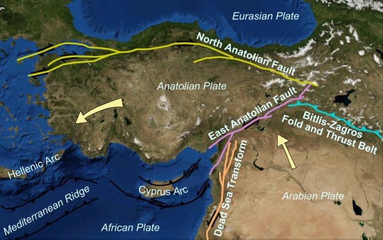
Tectonic settingEdit
The Karlıova region is the location of the triple junction between the boundaries of the Eurasian Plate, Anatolian Plate and the Arabian Plate, the North Anatolian Fault, East Anatolian Fault and the Mus fold and thrust belt, which passes to the east into the Zagros fold and thrust belt. The earthquake occurred at the eastern end of the North Anatolian Fault.
CharacteristicsEdit
The seismic moment estimated for this earthquake is 3.5E+26, equivalent to a magnitude of 7.1 on the moment magnitude scale. The estimated fault length involved is 63 km.