Origin time 5:54 P.M. PST Depth 10 km (6.2 mi) Max. intensity VIII (Severe) Date 10 March 1933 | Magnitude 6.4 Mw Type Strike-slip Total damage 40 million USD | |
 | ||
Similar 1971 San Fernando earthquake, 1987 Whittier Narrows, 1857 Fort Tejon earthquake, 1872 Lone Pine earthquake, 1980 Eureka earthquake | ||
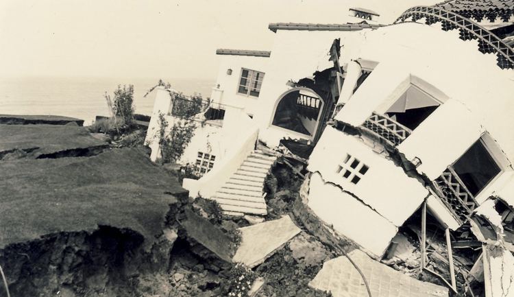
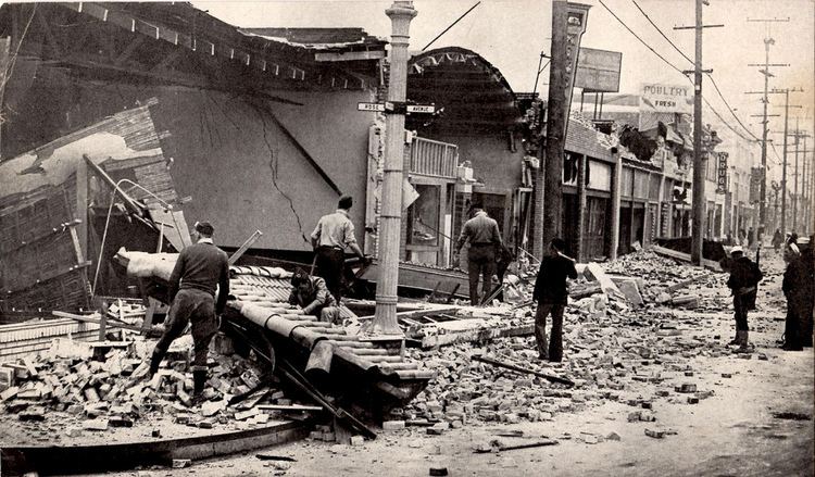
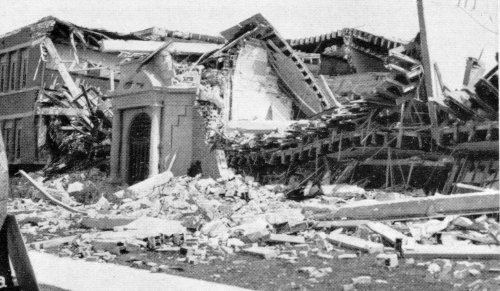
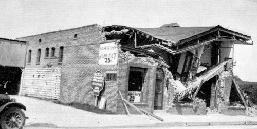
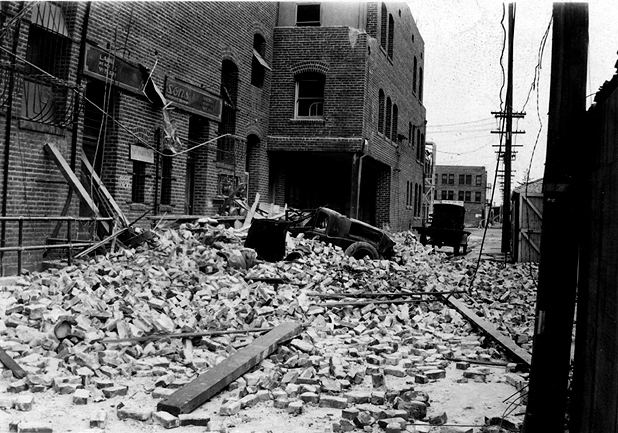
The 1933 Long Beach earthquake took place on March 10 at 5:54 P.M. PST south of downtown Los Angeles. The epicenter was offshore, southeast of Long Beach, California, on the Newport–Inglewood Fault. The earthquake had a moment magnitude of 6.4 and a maximum Mercalli intensity of VIII (Severe). Damage to buildings was widespread throughout Southern California. An estimated forty million dollars' worth of property damage resulted, and between 115 and 120 people died. Many of these fatalities occurred as people ran out of buildings and were hit by falling debris.
Contents
1933 long beach earthquake footage
Damage
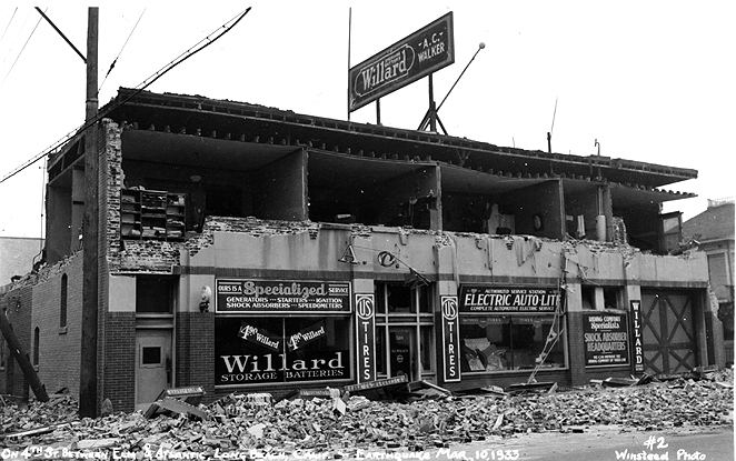
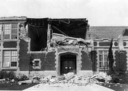
The major damage occurred in the densely-populated city of Long Beach on the south-facing coast of Los Angeles County, and extended to the industrial area south of downtown Los Angeles. Unfavorable geological conditions (landfill, water-soaked alluvium) combined with poorly constructed buildings increased the damage done by the quake. At Long Beach, buildings collapsed, water tanks fell through roofs, and houses were tossed off their foundations. School buildings were among the structures that incurred the most severe damage.
Aftermath
The earthquake highlighted the need for earthquake-resistant design for structures in California. Many school buildings were damaged, with more than 230 school buildings that either were destroyed, suffered major damage, or were judged unsafe to occupy. The California State Legislature passed the Field Act on April 10, 1933, mandating that school buildings must be earthquake-resistant. If the earthquake had occurred during school hours, the death toll would have been much higher.