
Time zone CET (UTC+1) Area 210 km² | Area code(s) +387 32 Local time Monday 4:33 AM | |
 | ||
Weather 8°C, Wind S at 5 km/h, 73% Humidity | ||
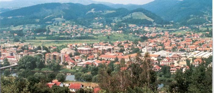
Žepče is a town and municipality in central Bosnia and Herzegovina, located between Doboj and Zenica. It is administratively part of the Zenica-Doboj Canton of the Federation of Bosnia and Herzegovina.
Contents
Map of %C5%BDep%C4%8De, Bosnia and Herzegovina
About Žepče
The town Žepče is located in the central Bosnia, towards the highway M-17. The river Bosna flows through this town. Near by the town and within the town, there are 14 springs of mineral water. Žepče is in the valley and surrounded by mountains.
History
The town was first mentioned in 1458 in a charter issued by the Bosnian king Stjepan Tomašević.
"... Pissanna Žepču va ljetu 1458. oktombrija 14. dan." (Written in Žepče in the year 1458. 14.day of October)
Demographics
In 2001 the following Croat villages from the municipalities of Maglaj and Zavidovići merged with the municipality of Žepče to form one entity with Croat majority: Adže, Pire, Ponijevo, Matina, Ljubatovići, Grabovica, Čustovo Brdo, Komšići, Radunice, Globarica, Brankovići, Donji Lug, Gornji Lug, Vrbica, Debelo Brdo, Osova, Vinište and Gornja Lovnica.
Sport
The town was home to local football club NK Žepče (dissolved).