
Country Czech Republic Time zone CET (UTC+1) Population 124,745 (2007) | Region Olomouc Region Area 1,313 km² Capital Šumperk | |
 | ||
Clubs and Teams Hokej Šumperk 2003, SK Loštice, FC Dubicko, TJ Sokol Lázně Velké Losiny, TJ Maletín Points of interest Hrubý Jeseník, Jeseníky, Ski areál Kouty, Paprsek, Králický Sněžník Destinations Staré Město, Šumperk, Velké Losiny, Hanušovice, Zábřeh | ||
Šumperk District (Czech: Okres Šumperk) is a district (okres) within the Olomouc Region of the Czech Republic with a population of 123 890. It covers area of 1313,06 km². Its administrative centre is the town of Šumperk.
Contents
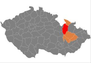
- Map of C5A0umperk District Czechia
- Geography
- Demography
- Nationalities
- Citizenships
- Confessions
- Geology
- Complete list of municipalities
- References
Map of %C5%A0umperk District, Czechia
Šumperk District shares border with the districts of Olomouc (to the south), Svitavy District (to the south-west), Ústí nad Orlicí District (to the north-west), Polish Kłodzko County (to the north), Jeseník District (to the north-east) and Bruntál District (to the east).
Geography
(Mohelnicko)
Šumperk District is part of Moravia except an area around Malá Morava village and Štíty town witch belongs to Bohemia. The highest point is The Praděd mountain (1492 meters) situated on a north, the lowest point is a floodplain of Morava river (339 meters) south of Loštice town.
District's surface is mostly mountainous and hilly. Wide lowland of Mohelnická brázda depression is situated in the center and most population lives there.
Demography
126 567 people live here in 2011. Most populated towns are Šumperk, Zábřeh and Mohelnice.
Nationalities
Citizenships
Confessions
Geology
Most rocks are metamorphic and igneous. The District has several deposits of minerals.
Area – mineral
Complete list of municipalities
Bludov - Bohdíkov - Bohuslavice - Bohutín - Branná - Bratrušov - Brníčko - Bušín - Dlouhomilov - Dolní Studénky - Drozdov - Dubicko - Hanušovice - Horní Studénky - Hoštejn - Hraběšice - Hrabišín - Hrabová - Hynčina - Chromeč - Jakubovice - Janoušov - Jedlí - Jestřebí - Jindřichov - Kamenná - Klopina - Kolšov - Kopřivná - Kosov - Krchleby - Lesnice - Leština - Libina - Líšnice - Loštice - Loučná nad Desnou - Lukavice - Malá Morava - Maletín - Mírov - Mohelnice - Moravičany - Nemile - Nový Malín - Olšany - Oskava - Palonín - Pavlov - Petrov nad Desnou - Písařov - Police - Postřelmov - Postřelmůvek - Rájec - Rapotín - Rejchartice - Rohle - Rovensko - Ruda nad Moravou - Sobotín - Staré Město - Stavenice - Sudkov - Svébohov - Šléglov - Štíty - Šumperk - Třeština - Úsov - Velké Losiny - Vernířovice - Vikantice - Vikýřovice - Vyšehoří - Zábřeh - Zborov - Zvole