
Elevation 853 m | Area 256 ha | |
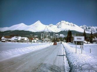 | ||
Štôla is a village and small municipality in Poprad District in the Prešov Region of northern Slovakia. It lies on the foothills of High Tatras.
Contents
Map of %C5%A0t%C3%B4la, Slovakia
History
In historical records the village was first mentioned in 1330.
Geography
The municipality lies at an altitude of 840 metres and covers an area of 2.555 km². It has a population of about 550 people.
Econony and infrastructure
The village has a developed touristic infrastructure with several types and categories of accommodation. Cultural sightseeing is neo-classical evangelical church from 19th century.
References
Štôla Wikipedia(Text) CC BY-SA