
Location Adriatic sea Length 9.1 km (5.65 mi) Highest elevation 243 m (797 ft) Elevation 243 m | Width 2.6 km (1.62 mi) Highest point Velji Vrh Area 16.22 km² | |
 | ||
Similar | ||
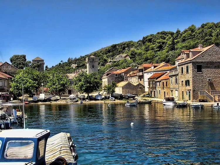
Šipan ([ʃǐpan]) also Sipano (Italian: Giuppana) is the largest of the Elaphiti Islands, 17 km (11 mi) northwest of Dubrovnik, Croatia; separated from the mainland coast by the Koločepski Channel; area 16.22 km2 (6.3 sq mi); The population is 500, the island is 9.1 km (5.7 mi) in length, and up to 2.6 km (1.6 mi) in width. It is the largest island in this group and its highest point is 243 m (797 ft) above sea level. Two limestone crests, the higher (Velji Vrh, 243 m) in the northeast and the lower in the southeast surround a dolomite depression, on which olives, figs, vine, carob-trees, almond-trees, oranges and citrus fruit are cultivated. There are two ports on the island, Suđurađ (San Giorgio) in the east, and Šipanska Luka (Porto Gippana) in the west. The island is also famed for its numerous palm tree species that grow on the island.
Map of %C5%A0ipan, 20223, Croatia
It was first mentioned by this name in documents of 1371.
In 1426 it became part of Ragusa.
During the French Revolutionary Wars, the British Royal Navy referred to it as Zupano. On 17 June 1813 a landing party of marines and seamen from HMS Saracen captured the French garrison.