
Country Poland Car plates DSR Population 50,119 (2009) | Seat Środa Śląska Area 703.7 km² Capital Środa Śląska | |
 | ||
Gminas Total 5
Gmina Kostomłoty
Gmina Malczyce
Gmina Miękinia
Gmina Środa Śląska
Gmina Udanin Voivodeship Lower Silesian Voivodeship Points of interest Muzeum Regionalne w Środzie, Mury obronne, Pałac w Gałowie, Ratusz, Rezerwat przyrody Zabór | ||
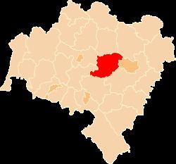
Środa Śląska County (Polish: powiat średzki) is a unit of territorial administration and local government (powiat) in Lower Silesian Voivodeship, south-western Poland. It came into being on January 1, 1999, as a result of the Polish local government reforms passed in 1998. The county covers an area of 703.7 square kilometres (271.7 sq mi). Its administrative seat and only town is Środa Śląska.
Contents
Map of %C5%9Aroda %C5%9Al%C4%85ska County, Poland
As at 2006 the total population of the county is 49,208, out of which the population of Środa Śląska accounts for 8,800, while the rural population is 40,408.
Neighbouring counties
Środa Śląska County is bordered by Wołów County to the north, Trzebnica County to the north-east, the city of Wrocław and Wrocław County to the east, Świdnica County to the south, and Jawor County and Legnica County to the west.
Administrative division
The county is subdivided into five gminas (one urban-rural and four rural). These are listed in the following table, in descending order of population.