
Location Masurian Lake District Basin countries Poland Max. width 13.4 km (8.3 mi) Area 113.8 km² Volume 0.65 km³ Surface elevation 117 m | Type Glacial lake Max. length 22.1 km (13.7 mi) Surface area 113.8 km (43.9 sq mi) Length 22.1 km Width 13.4 km Mean depth 6.5 m | |
 | ||
Magnetic rock found in niardwy lake poland
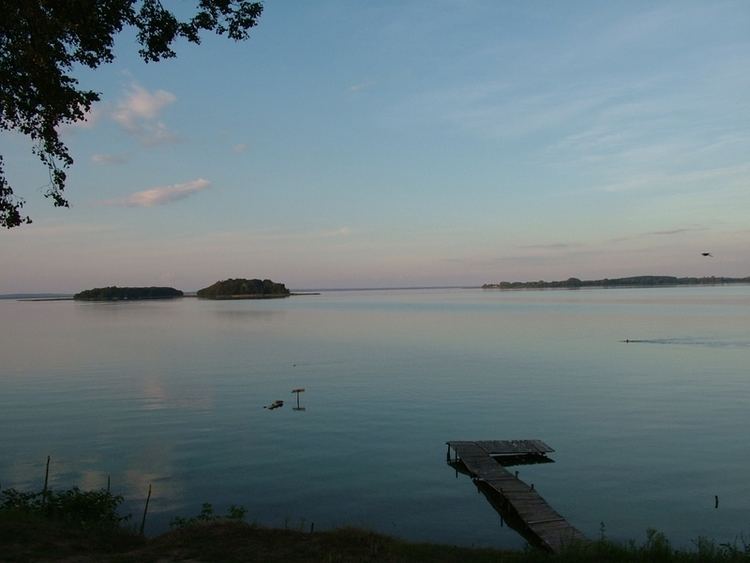
Śniardwy (German: der Spirdingsee ) is a lake in the Masurian Lake District of the Warmian-Masurian Voivodeship, Poland. It is the largest lake in Poland with an area of 113.8 square kilometres (43.9 sq mi). It is 22.1 kilometres (13.7 mi) long and 13.4 kilometres (8.3 mi) wide. The maximum depth is 23 metres (75 feet). There are eight islands on the Śniardwy lake.
Contents
- Magnetic rock found in niardwy lake poland
- Map of C59Aniardwy Poland
- Jezioro niardwy the biggest polish lake mazury 4k
- GeographyEdit
- References
Map of %C5%9Aniardwy, Poland
Jezioro niardwy the biggest polish lake mazury 4k
GeographyEdit
Śniardwy was formed by retreating ice sheet and draining floodwaters occurring as the result of ice calving ahead of the receding glacier. Among the eight islands are: Szeroki Ostrów, Czarci Ostrów, Wyspa Pajęcza, Wyspa Kaczor and others. Surrounding settlements include Popielno, Głodowo, Niedźwiedzi Róg, Okartowo, Nowe Guty, Zdęgowo and Łuknajno.
Among the many inlets, two are named as separate lakes: Warnołty and Seksty. Śniardwy connects with the following lakes: Tuchlin, Łuknajno, Mikołajskie, Roś, Białoławki and Tyrkło. It is surrounded by the system of canals known as Kanały Mazurskie (Masurian Canals), with numerous sluices. Together, they form the Polish Masurian Lake District.