
District Ōra Population 26,380 (Feb 2015) Local time Monday 1:56 AM | Region Kantō Area 31.11 km² | |
 | ||
Weather 5°C, Wind NW at 11 km/h, 64% Humidity | ||
Ōra (邑楽町, Ōra-machi) is a town located in Ōra District, Gunma Prefecture, in the northern Kantō region of Japan. As of February 2015, the town had an estimated population of 26,380 and a population density of 848 persons per km². Its total area was 31.11 km².
Contents
- Map of Ora Ora District Gunma Prefecture Japan
- Geography
- Surrounding municipalities
- History
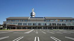
- Education
- Railway
- Highway
- Local attractions
- References
Map of Ora, Ora District, Gunma Prefecture, Japan
Geography
Ōra is located in the extreme southern corner Gunma prefecture, bordered by Tochigi Prefecture to the north.
Surrounding municipalities
History
The villages of Nakano, Takashima and Nagae were created within Ōra District, Gunma Prefecture on April 1, 1889 with the creation of the municipalities system after the Meiji Restoration. On March 1, 1955, Nakano and Takashima merged to form the village of Nakajima. Nakae merged with neighboring Tominaga and Eiraku to form the village of Chiyoda. However, on September 30, 1956 the former Nakae village was transferred from Chiyoda to Nakajima, and Nakajma was renamed Ōra on January 1, 1957. Ōra was elevated to town status on April 1, 1968.