
Phone number 0237-62-2111 Population 8,721 (Nov 2013) | Area 153.9 km² Local time Monday 1:04 AM | |
 | ||
Weather -1°C, Wind SW at 6 km/h, 87% Humidity | ||
Ōe (大江町, Ōe-machi) is a town located in Yamagata Prefecture, Japan.
Contents
- Map of Oe Nishimurayama District Yamagata Prefecture Japan
- Geography
- Neighboring municipalities
- Climate
- History
- Economy
- Railway
- Highway
- Events
- Landmarks
- References
Map of Oe, Nishimurayama District, Yamagata Prefecture, Japan
As of November 2013, the town had an estimated population of 8,721 and a population density of 56.7 persons per km2. The total area was 153.92 square kilometres (59 sq mi).
Geography
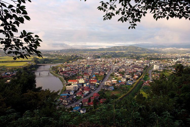
Ōe is located in mountainous central Yamagata. Like many small towns in Japan, Ōe is a collection of smaller hamlets. Elevation rises and populations decrease from east to west. The easternmost hamlet is Aterazawa, and contains about 4/5 of the town's population. The Mogami River forms the eastern border of the town.
Neighboring municipalities
Climate
Ōe has a Humid continental climate (Köppen climate classification Dfa) with large seasonal temperature differences, with warm to hot (and often humid) summers and cold (sometimes severely cold) winters. Precipitation is significant throughout the year, but is heaviest from August to October.
History
The area of present-day Ōe was part of ancient Dewa Province. During the Kamakura period it was controlled by the Ōe clan. During the early Tokugawa period, it was the site of a castle and center of the briefly-lived Aterazawa Domain (12,000 koku), which was absorbed into Tsuruoka Domain. After the start of the Meiji period, the area became part of Nishimurayama District, Yamagata Prefecture. The modern town of Ōe was established on August 20, 1959 by the merger of the town of Aterazawa and the village of Urushikawa.
Economy
The economy of Ōe is based on agriculture.