
Car plates RLA Capital Łańcut | Seat Łańcut Area 452 km² | |
 | ||
Gminas Total 7 (incl. 1 urban)ŁańcutGmina BiałobrzegiGmina CzarnaGmina ŁańcutGmina MarkowaGmina RakszawaGmina Żołynia Points of interest Łańcut Castle, Maneż ‑ Kasy Muzeum, Storczykarnia, Zamek Lubomirskich i Potockich, Łańcut Synagogue Destinations | ||
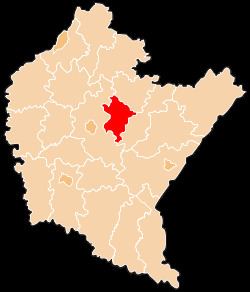
Łańcut County (Polish: powiat łańcucki) is a unit of territorial administration and local government (powiat) in Subcarpathian Voivodeship, south-eastern Poland. It came into being on January 1, 1999, as a result of the Polish local government reforms passed in 1998. Its administrative seat and only town is Łańcut, site of the famous Łańcut Castle, lying 17 kilometres (11 mi) east of the regional capital Rzeszów.
Contents
Map of %C5%81a%C5%84cut County, Poland
The county covers an area of 451.95 square kilometres (174.5 sq mi). As of 2006 its total population is 77,710, out of which the population of Łańcut is 18,067 and the rural population is 59,643.
Neighbouring counties
Łańcut County is bordered by Leżajsk County to the north, Przeworsk County to the east, and Rzeszów County to the west.
Administrative division
The county is subdivided into seven gminas (one urban and six rural). These are listed in the following table, in descending order of population.