
Country Vietnam Capital Đình Lập Area 1,183 km² Province Lang Son Province | Region Northeast Time zone UTC + 7 (UTC+7) Population 28,125 (2003) | |
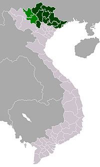 | ||
Đình Lập is a rural district of Lạng Sơn Province in the Northeastern region of Vietnam. As of 2003 the district had a population of 28,125. The district covers an area of 1,183 km². The district capital lies at Đình Lập.
Contents
Map of %C4%90%C3%ACnh L%E1%BA%ADp, L%E1%BA%A1ng S%C6%A1n, Vietnam
Administrative divisions
Đình Lập, Nông Trường Thái Bình, Lâm Ca, Đồng Thắng, Bắc Lãng, Châu Sơn, Cường Lợi, Thái Bình, Đình Lập, Bính Xá, Kiên Mộc, Bắc Xa.
References
Đình Lập District Wikipedia(Text) CC BY-SA