
Elevation 400 m Local time Sunday 10:33 AM | Area 10.29 km² | |
 | ||
Weather 15°C, Wind NW at 6 km/h, 63% Humidity | ||
Čimelice is a larger village in the north of the Písek District, along the route which connects South Bohemia with Prague and which is widely known as "R4" or "Strakonická" (named after the town of Strakonice).
Contents
Map of 398 04 %C4%8Cimelice, Czechia
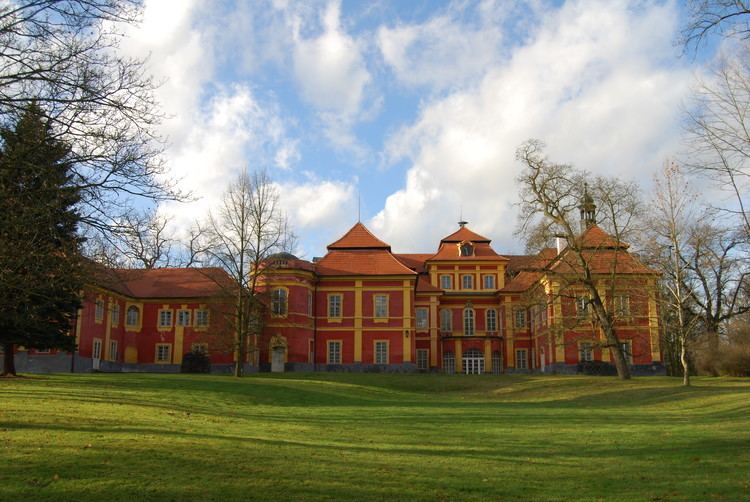
In the village there is a railway station (connection Písek-Zdice), the Church of Holy Trinity, many shops, a Castle from 1720 and a pond in the centre of the village. The village is known for autumn gardening fairs. Near Čimelice, there are a number of large ponds, such as Bisingrovský, Zhoř, Nerestec, Stejskal, Valný, Zástava. In the catastr of the village there is a small river called the Skalice, which is a tributary of the Otava river.
Statistics
Neighbouring villages
References
Čimelice Wikipedia(Text) CC BY-SA