
Country Turkey Province Nevşehir Postal code 50xxx Elevation 1,043 m | Region Central Anatolia Time zone EET (UTC+2) Area code(s) 0384 Local time Sunday 8:34 AM | |
 | ||
Weather 4°C, Wind N at 2 km/h, 89% Humidity Points of interest Turasan, Asmali Konak, Esbelli House, Ürgüp Museum, ürgüp müzesi | ||
Mustafapa a nev ehir u rgu p turkey
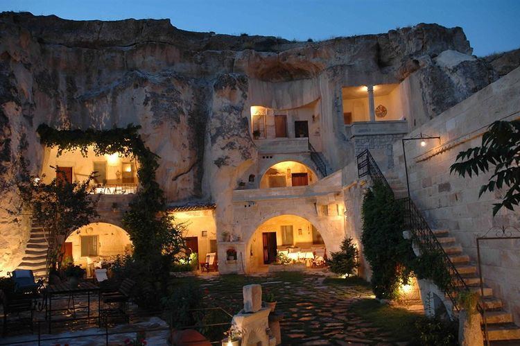
Ürgüp (Greek: Προκόπιο Prokópio or Cappadocian Greek: Προκόπι Prokópi, Ottoman Turkish: Burgut Kalesi) is a town and district of Nevşehir Province in the Central Anatolia region of Turkey. It is located in the historical region of Cappadocia, and near the cave Churches of Göreme. According to 2010 census, the population of the district is 34,372 of which 18,631 live in the town of Ürgüp. The district covers an area of 563 km2 (217 sq mi), and the town lies at an average elevation of 1,043 m (3,422 ft).
Contents
- Mustafapa a nev ehir u rgu p turkey
- Map of C39CrgC3BCp NevC59Fehir Turkey
- Twin towns Sister cities
- References
Map of %C3%9Crg%C3%BCp, Nev%C5%9Fehir, Turkey
Cappadocia is one of Turkey’s largest wine-producing regions, with Urgup as its capital. Uphill from Hotel Surban, the renowned Turasan Winery supplies 60% of Cappadocia’s wines and offers free tours and tastings in its rock-carved wine cellar.
Twin towns – Sister cities
Ürgüp is twinned with: