
Elevation 1,751 m Mountain range Saltfjellet | Prominence 1,076 m Parent range Saltfjellet | |
 | ||
Location Saltdal, Nordland, Norway Topo map 2128 IV Junkerdal (north) and 2128 III Lønsdal (south) Similar Nordre Saulo, Satertind, Lønstinden, Skjelåtinden, Suliskongen | ||
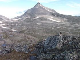
Ølfjellet (Lule Sami: Uvbágájsse) is the highest mountain in the Saltfjellet mountain range in Nordland county, Norway. It is located in the municipality of Saltdal roughly halfway between the lakes Nordre Bjøllåvatnet and Kjemåvatnet. The village of Lønsdal lies about 1.6 kilometres (0.99 mi) southeast of the mountain.
Contents
Map of %C3%98lfjellet, 8255 R%C3%B8kland, Norway
The mountain has two peaks, the highest being 1,751 metres (5,745 ft). Approximately 1.5 kilometres (0.93 mi) north of the highest peak is the other peak with height of 1,651 metres (5,417 ft).
Name
The first element is øl which means "haze" (not "beer"), and the last element is the finite form of fjell which means "mountain".
References
Ølfjellet Wikipedia(Text) CC BY-SA