
Local time Sunday 6:04 AM | ||
 | ||
Weather 1°C, Wind E at 8 km/h, 92% Humidity | ||
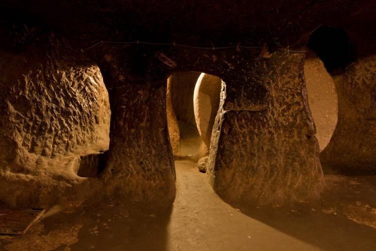
Özkonak Underground City is an ancient city built into the northern slopes of Mt. Idis about 14 km northeast of Avanos in Nevşehir Province, in the Central Anatolia region of Turkey.
Contents
- Map of C396zkonak Underground City 50500 C396zkonak Belediyesi2FAvanos2FNevC59Fehir Turkey
- zkonak yeralt yerle kesi zkonak underground city
- Description
- History
- References
Map of %C3%96zkonak Underground City, 50500 %C3%96zkonak Belediyesi%2FAvanos%2FNev%C5%9Fehir, Turkey
zkonak yeralt yerle kesi zkonak underground city
Description
The city has many strata made up of volcanic granite. Its larger areas are connected to each other by tunnels, and it contains a pipe communication system reaching each of its levels. This feature is unique when compared to the Kaymaklı Underground City and the Derinkuyu Underground City. Each carved room had ventilation provided by further piping when the city was sealed during sieges.
History
The city was probably built by the people of Byzantine Cappadocia, although the age is uncertain and could be older.
The Özkonak Underground City was discovered in 1972 by a local farmer named Latif Acar, who was curious about where his excess crop water was disappearing to. Latif discovered an underground room which, when later excavated, revealed a whole city which could house 60,000 people for up to three months. Although only four floors are now open, the complex contains a total of ten floors, to a depth of 40m.
Unlike the other underground cities in this area, there were holes above the tunnels used for dumping hot oil on the enemy. Just like Kaymaklı and Derinkuyu, Özkonak has a water well, ventilation system, winery and moving stone doors.