
Area 33 km² | Region Western Norway Adm. Center Åkrahamn Local time Sunday 12:47 AM | |
 | ||
Weather 7°C, Wind S at 11 km/h, 95% Humidity | ||
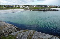
Åkra is a former municipality in the traditional district of Haugaland in Rogaland county, Norway. The 33-square-kilometre (13 sq mi) municipality existed from 1892 until 1965 and it encompassed the central part of the western coast of the island of Karmøy. The administrative centre was the village of Åkrahamn.
Contents
Map of 4270 %C3%85kra, Norway
History
The municipality of Aakra was established on 1 January 1892 when it was split off from the municipality of Skudenes. Initially, the new municipality had a population of 1,962. On 1 January 1965, the municipality of Åkra was dissolved due to recommendations by the Schei Committee. Åkra was merged with the neighboring municipalities of Avaldsnes, Skudenes, Stangaland, and Torvastad and with the towns of Kopervik and Skudeneshavn to form the new, larger municipality of Karmøy. Before the merger Åkra had a population of 6,008.
Attractions
The Old Åkra Church (Åkra gamle kyrkje) dates back to 1821. It was built of wood and has 320 seats. The church was restored in 1852 and 1899. Rogaland Fishery Museum (Rogaland Fiskerimuseum) is situated on the harbor in Åkrahamn. It contains a restored herring works with a collection of artifacts and equipment associated with the local fishing and shipping industries.