
Country Serbia Status Municipality Time zone CET (UTC+1) Area 155 km² Local time Sunday 10:58 AM | City Belgrade Settlements 8 Postal code 11030 Population 179,031 (2011) | |
 | ||
Weather 21°C, Wind SE at 19 km/h, 30% Humidity Points of interest Ada Ciganlija, Trim track KOSUTNJAK, Spomenik braniocima Beograda | ||
Čukarica (Serbian Cyrillic: Чукарица, [t͡ʃukǎrit͡sa]) is an urban neighborhood and one of the 17 municipalities that constitute the city of Belgrade, the capital of Serbia.
Contents
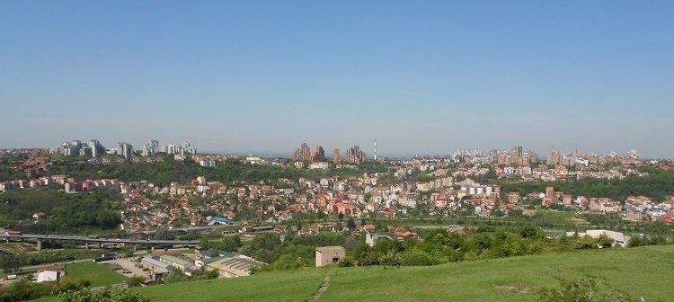
- Map of C48Cukarica Serbia
- Neighbourhoods
- Demographics
- Location and Importance
- History
- Politics
- Neighborhood
- International cooperation
- References
Map of %C4%8Cukarica, Serbia
Neighbourhoods
Municipality of Čukarica covers an area of 155 km2 (60 sq mi) and it is divided in the urban and suburban part.
Urban part of the municipality is completely within the Belgrade City proper, comprising many neighborhoods and sub-neighborhoods, some of which used to be separate towns until the 1970s before Belgrade expanded that much to make urban connection to them (Žarkovo, Železnik):
The suburban part comprises seven suburban settlements, four of them classified as urban and three as rural settlements:
Demographics
The municipality has a population of 181,231 inhabitants, according to the 2011 census results. That makes Čukarica the second most populous municipality of Belgrade (after Novi Beograd), but it is also the fastest growing one in terms of absolute growth of population (relative, about 1.05% annually). Despite having also a rural part, the municipality is very densely populated – 1,155/km2 (2,990/sq mi).
Ethnic structure (2002): Serbs 91.3%, Montenegrins 1.4%, Romani 1.1%, Yugoslavs 1.1%, ethnic Macedonians 0.5%, Croats 0.5%.
Location and Importance
Čukarica is completely surrounded by other municipalities of Belgrade: it is bordered by the Sava river to the west, municipalities of Savski Venac to the north and northeast, Rakovica to the east, Voždovac to the southeast, Barajevo to the south and Obrenovac to the southwest.
Municipality is located southwest from the downtown Belgrade. It comprises the vast marshy woods of Makiš, on the eastern bank of the Sava river and the largest river island in Belgrade, Ada Ciganlija. At the suburb of Sremčica, Beogradski merokras, the most northern terrain made of limestone (karst) is located.
Several of the most important roads in western Serbia start here, Ibarska magistrala, Savska magistrala, Obrenovački put, etc. Also, the largest and most important freight train station and marshalling yard in the area and the main installations of the Belgrade waterworks, including the water factory, are located in the municipality (Makiš).
Čukarica was the first part of Belgrade that developed industry, in the late 19th and early 20th century and still is one of the most industrialized parts of Belgrade (Železnik, Žarkovo, Bele Vode), with commercial sections of the municipalities booming in the last 20 years (Banovo Brdo).
Officially the longest street in Belgrade, Obrenovački put (Obrenovač road) is located in the municipality. According to Belgrade's Directory of Roads, it is 11 kilometers long. However, as the road passes through the forests and mainly uninhabited areas and stretches outside the urban Belgrade City proper (uža teritorija grada), most Belgraders consider the 7.5-kilometer-long Bulevar kralja Aleksandra to be the longest street. While Obrenovač road runs only through one municipality (Čukarica), Bulevar kralja Aleksandra connects four of them: Stari Grad, Vračar, Palilula and Zvezdara.
History
Municipality of Čukarica was established for the first time on 30 December 1911. After World War II when Belgrade municipalities were abolished and city divided in districts (rejon/рејон), Čukarica was part of Rejon VII 1945–50. Municipality was re-established in 1957. In 1960. the neighboring municipalities of Umka and Rakovica were incorporated into Čukarica, but Rakovica became separate municipality again in 1974.
Politics
Historical Presidents of the Municipal Assembly since 1989:
Neighborhood
The neighborhood of Čukarica, which gave the name to the entire municipality, is located on a hill above the eastern bank of the Sava river. It is bordered by Careva Ćuprija and Senjak to the north, Banovo Brdo
International cooperation
Čukarica is twinned with following cities and municipalities: