
- left Sohanambo River - elevation 193 m (633 ft) | - elevation 2,600 m (8,530 ft) | |
 | ||
- location between Bekininy and Sakananjy, Ihorombe | ||
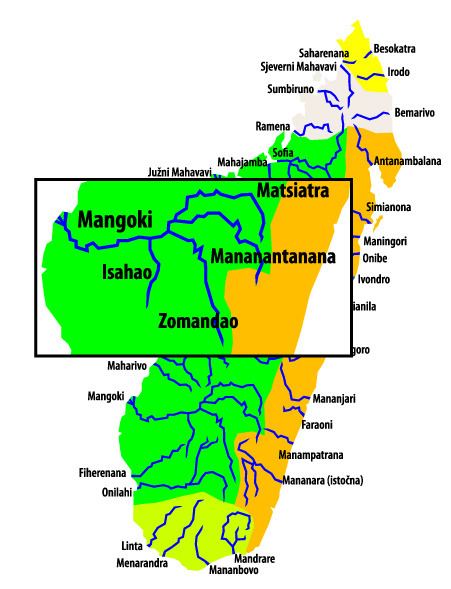
Zomandao is a river of 283 km length in the regions of Haute Matsiatra and Ihorombe in central-southern Madagascar. It takes it sources in the Andringitra Massif at the Boby Peak, the 2nd highest peak of Madagascar to flow down the Zomandao plaine. It is one of the main tributary of the Mangoky river. It forms also some waterfalls, the Riandahy Falls and Rianbavy Falls.
Map of Zomandao, Madagascar
References
Zomandao River Wikipedia(Text) CC BY-SA