
- location Amur river Length 1,242 km Basin area 233,000 km² Country Russia | - min 1.5 m/s (53 cu ft/s) Discharge 1,800 m³/s Mouth Amur River | |
 | ||
- location Tokiysky Stanovik, Amur Oblast - average 1,800 m/s (63,566 cu ft/s) - max 14,200 m/s (501,468 cu ft/s) | ||
Zeya River (Russian: Зе́я; from indigenous Evenki word "dgeœ" (blade); Manchu: ᠵᡳᠩᡴᡳᡵᡳ
ᠪᡳᡵᠠ), 1,242 km long, is a northern tributary of the Amur River. It rises in the Tokiysky Stanovik mountain ridge, a part of the Stanovoy Range. The first Russian to enter the area was Vassili Poyarkov.
Map of Zeya River, Amur Oblast, Russia
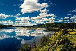
Zeya flows through the Zeya Reservoir and joins the Amur River near Blagoveshchensk, in Russia's Amur Oblast. Regulation of river discharge by Zeya Dam mitigates extrimities of river flow down to 5000 m³/s.
The main tributaries of the Zeya River are Tok, Mulmuga, Bryanta, Gilyuy, and Urkan on the right, and Kupuri, Argi, Dep, Selemdzha, and Tom on the left.
The river freezes from November to May. It is navigable with the most important river ports being Zeya, Svobodny, and Blagoveshchensk.