
Area 188.8 km² | ||
 | ||
Time zone Central Standard Time (UTC-6) | ||
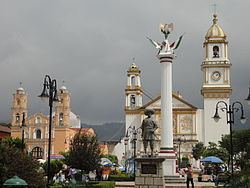
Zacapoaxtla Municipality is a municipality in Puebla in south-eastern Mexico.
Map of Zacapoaxtla, Puebla, Mexico
Zacapoaxtla Municipality is located in the mountains northeast of Puebla, between geographical coordinates 19° 44' 18 and 19° 59' 18 N latitude and 97° 31' 42 and 97° 37' 54 W longitude.
Zacapoaxtla is bounded
It has an area of 188.8 km², that makes it the 66th largest with respect to the other municipalities of the state of Puebla.
References
Zacapoaxtla (municipality) Wikipedia(Text) CC BY-SA