
Basin size 7,240 km (2,800 sq mi) Basin area 7,240 km² Country Russia | Length 404 km Discharge 55 m³/s | |
 | ||
Main source Yamantaw, South Urals
960 m (3,150 ft) River mouth Pavlovskoye Dam
140 m (460 ft) | ||
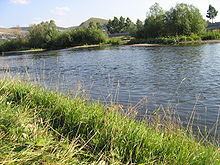
Yuryuzan River (Russian: Юрюза́нь, Yuryuzán; Bashkir: Йүрүҙән, Yürüðän) is a river in the Republic of Bashkortostan and Chelyabinsk Oblast in Russia, a left tributary of the Ufa River (Kama basin). The length of the river is 404 kilometers (251 mi). The area of its basin is 7,240 square kilometers (2,800 sq mi). The Yuryuzan River flows into the Pavlovskoye Reservoir near Karaidel. It freezes up in the second half of October – early December and stays under the ice until April. The river is navigable within the first 16 kilometers (9.9 mi) of its estuary. The towns of Yuryuzan and Ust-Katav are located on the Yuryuzan River. The Yuryuzan River is very popular river for easy rafting.
Map of r. Yuryuzan', Russia
The name of the river originates from the Bashkir language and means "The big river".
Media related to Yuryuzan River at Wikimedia Commons