
OS grid reference SE766556 Sovereign state United Kingdom Postcode district YO41 | Local time Sunday 6:01 PM Dialling code 01759 | |
 | ||
Unitary authority Weather 17°C, Wind W at 31 km/h, 59% Humidity | ||
Youlthorpe is a hamlet in the East Riding of Yorkshire, England. It forms part of the civil parish of Bishop Wilton. It is situated approximately 10 miles (16 km) east of York, 5 miles (8 km) north-west of Pocklington and just south of the main A166 road from York to Bridlington.
Map of Youlthorpe, York, UK
From 1886 Youlthorpe was part of the civil parish of Youlthorpe with Gowthorpe which was abolished on 1 April 1935 with the creation of the civil parish of Bishop Wilton.
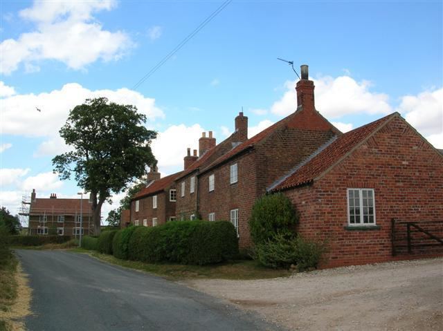
East farmhouse in the settlement was designated a Grade II listed building in 1987 and is now recorded in the National Heritage List for England, maintained by Historic England.
References
Youlthorpe Wikipedia(Text) CC BY-SA