
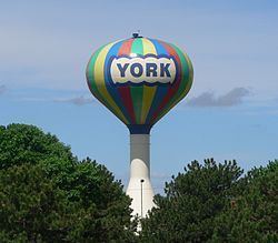
Country United States County York Time zone Central (CST) (UTC-6) Population 7,961 (2013) University York College | State Nebraska Elevation 1,601 ft (488 m) Area code(s) 402 Zip code 68467 | |
 | ||
Weather 13°C, Wind S at 0 km/h, 92% Humidity Points of interest York Children's Museum, Miller Park, Clayton Museum of Ancient H | ||
York is a city and county seat of York County, Nebraska, United States. As of the 2010 census, the city population was 7,766. It is the home of York College and the Nebraska Correctional Center for Women.
Contents
- Map of York NE 68467 USA
- History
- Geography
- 2010 census
- 2000 census
- Education
- Media
- Notable people
- References
Map of York, NE 68467, USA
History
York was platted in 1869. The city took its name from York County.
Geography
York is located in 40°52′2″N 97°35′20″W (40.867295, -97.588869). The city sits at the crossroads of Interstate 80, a major east-west highway, and U.S. Route 81, a major north-south highway.
According to the United States Census Bureau, the city has a total area of 5.77 square miles (14.94 km2), of which 5.75 square miles (14.89 km2) is land and 0.02 square miles (0.05 km2) is water.
2010 census
As of the census of 2010, there were 7,766 people, 3,253 households, and 1,992 families residing in the city. The population density was 1,350.6 inhabitants per square mile (521.5/km2). There were 3,633 housing units at an average density of 631.8 per square mile (243.9/km2). The racial makeup of the city was 94.9% White, 1.0% African American, 0.3% Native American, 0.7% Asian, 0.1% Pacific Islander, 1.8% from other races, and 1.2% from two or more races. Hispanic or Latino of any race were 4.4% of the population.
There were 3,253 households of which 27.4% had children under the age of 18 living with them, 49.4% were married couples living together, 8.4% had a female householder with no husband present, 3.4% had a male householder with no wife present, and 38.8% were non-families. 33.4% of all households were made up of individuals and 15.4% had someone living alone who was 65 years of age or older. The average household size was 2.26 and the average family size was 2.87.
The median age in the city was 39.4 years. 22.9% of residents were under the age of 18; 11.3% were between the ages of 18 and 24; 21.9% were from 25 to 44; 25.7% were from 45 to 64; and 18.2% were 65 years of age or older. The gender makeup of the city was 49.0% male and 51.0% female.
2000 census
As of the census of 2000, there were 8,081 people, 3,304 households, and 2,101 families residing in the city. The population density was 1,433.6 people per square mile (553.2/km²). There were 3,532 housing units at an average density of 626.6 per square mile (241.8/km²). The racial makeup of the city was 96.76% White, 0.74% African American, 0.15% Native American, 0.74% Asian, 0.11% Pacific Islander, 0.58% from other races, and 0.92% from two or more races. Hispanic or Latino of any race were 1.56% of the population.
There were 3,304 households out of which 29.0% had children under the age of 18 living with them, 53.3% were married couples living together, 7.8% had a female householder with no husband present, and 36.4% were non-families. 31.5% of all households were made up of individuals and 16.4% had someone living alone who was 65 years of age or older. The average household size was 2.31 and the average family size was 2.90.
In the city, the population was spread out with 23.7% under the age of 18, 11.7% from 18 to 24, 24.0% from 25 to 44, 22.4% from 45 to 64, and 18.2% who were 65 years of age or older. The median age was 38 years. For every 100 females there were 90.1 males. For every 100 females age 18 and over, there were 86.6 males.
As of 2000 the median income for a household in the city was $36,069, and the median income for a family was $45,544. Males had a median income of $31,014 versus $20,086 for females. The per capita income for the city was $17,813. About 6.3% of families and 9.2% of the population were below the poverty line, including 9.1% of those under age 18 and 8.1% of those age 65 or over.
Education
York Public Schools are part of the York Public Schools School District. Schools in the district include York Elementary School, York Middle School and York High School.
York has two parochial schools. Emmanuel-Faith Lutheran School opened in 1957. The pre-school is located at Faith Lutheran in York, while grades K-8 are located in a school attached to Emmanuel Lutheran Church. St. Joseph's is a Catholic elementary school that holds classes for grades PK-8.
Media
In the late 1800s, York fielded a number of newspapers. On January 1, 1883, the York Democrat was created from a previous paper known as the York Tribune. The York Republican was another newspaper that flourished during this time period and was notable for its large circulation. The York News-Times is York's only current newspaper of record.
York has two radio stations that have been locally owned since they signed on the air in 1954 (KAWL AM) and 1970 (KTMX FM), providing news, sports, music and entertainment to York and adjacent counties.