
Country United States Time zone ChST (UTC+10) Population 20,539 (2010) | Territory Guam Local time Sunday 1:30 PM Mayor Rudy M. Matanane (R) | |
 | ||
Weather 31°C, Wind E at 23 km/h, 67% Humidity Points of interest Ritidian Point, Guam National Wildlife R, Pagat Point, Mount Santa Rosa | ||
Peter s holiday village tour yigo guam
Yigo (Chamorro: Yigu; pronounced /ˈdʒiːɡoʊ/) is the northernmost village of the United States territory of Guam, and is the location of Andersen Air Force Base. The municipality of Yigo is larger than any other village on the island in terms of area. It contains a number of populated places, including Asatdas.
Contents
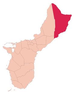
Map of Yigo, Guam
Yigo is historically one of Guam's richest farming areas. During World War II, the village was the site of a concentration camp during Japanese occupation of the island. It was also the site of the island's final battle during the war. The South Pacific Memorial Peace Park was built by the Japanese Government and is dedicated to the many Japanese and American soldiers who died in the battle of Guam.
Education
Yigo has several kindergarten through 5th grade elementary schools:
Simon Sanchez became a high school in 1982. The first graduating class graduated in May 1983.