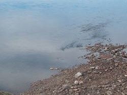
Main source Vilyuy Plateau Length 601 km Country Russia | River mouth Vilyuy River Mouth Vilyuy River | |
 | ||
Basin size 11,200 km (4,300 sq mi) Discharge Average rate:
30 m/s (1,100 cu ft/s) (near mouth) | ||
Ygyatta (Russian: Ыгыатта) or Ygyta (Ыгыта) is river and left tributary of the Vilyuy River.
Map of r. Ygyatta, Sakha Republic, Russia
The Ygyatta River is about 600 kilometres (370 mi) long, and its basin covers about 11,200 square kilometres (4,300 sq mi). The depth of the river at its mouth is near 10 metres (33 ft). It rises in the Vilyuy Plateau on the west of Sakha and is fed by rain and snowmelt.
The river and its banks are rich with gems: emeralds, rubies, sards, aquamarines, and others.
There are goldfields along the river.
Neighborhoods around the Ygyatta River are among the least populated places within Russia.
References
Ygyatta River Wikipedia(Text) CC BY-SA
